
IMAGES TAKEN NEAR TO
Cathcart Road, STOURBRIDGE, DY8 3UZ
Introduction
This page details the photographs taken nearby to Cathcart Road, DY8 3UZ by members of the Geograph project.
The Geograph project started in 2005 with the aim of publishing, organising and preserving representative images for every square kilometre of Great Britain, Ireland and the Isle of Man.

There are currently over 7.5m images from over14,400 individuals and you can help contribute to the project by visiting https://www.geograph.org.uk
Image Map
Images are licensed for reuse under creativecommons.org/licenses/by-sa/2.0
Notes
- Clicking on the map will re-center to the selected point.
- The higher the marker number, the further away the image location is from the centre of the postcode.
Image Listing (20 Images Found)
Images are licensed for reuse under creativecommons.org/licenses/by-sa/2.0
Image
Details
Distance
1
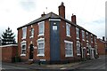
House on Brook Street
Victorian house on the corner of Brook Street and Cross Street.
Image: © Philip Halling
Taken: 4 Mar 2022
0.10 miles
2
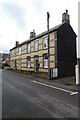
Houses on Cross Street
Houses built in polychromatic bricks on Cross Street.
Image: © Philip Halling
Taken: 4 Mar 2022
0.12 miles
3
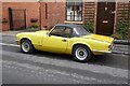
Triumph Spitfire MkIV
A 1972 K registration Triumph Spitfire MkIV. In the mid-1980s I had a Spitfire 1500, the replacement model. The car looks so small now.
Image: © Philip Halling
Taken: 4 Mar 2022
0.12 miles
4
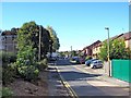
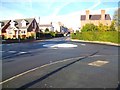
Mamble Road, Wollaston
A residential road, off Enville Street (the A458).
Image: © P L Chadwick
Taken: 25 Sep 2010
0.16 miles
6
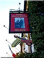
Katie Fitzgerald's - pub sign, 187 Enville Street, Wollaston
As the pub is named after the present owner's grandmother, the photograph on the sign presumably shows her grandparents. The musical instruments beneath, indicate this pub frequently has live music.
Image
Image: © P L Chadwick
Taken: 25 Sep 2010
0.18 miles
7
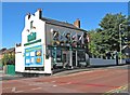
Katie Fitzgerald's, 187 Enville Street, Wollaston
A very popular pub named after the present owner's grandmother. It is on the corner of Enville Street and Mamble Road, and is one of several to be found along Enville Street. The pub has an interesting website, which includes detailed research on the pub's history by John Richards. According to this, the pub started out as a one-roomed beerhouse in the 1840's. It was known as The Golden Lion. It was in competition with a pub opposite, known as the Bridge Inn, which no longer exists. Both brewed their own beer. From August 1989, for a few years, it was known as The Stourbridge Lion. Today under its present name, the pub offers a range of beers and frequent live music.
Image
Image: © P L Chadwick
Taken: 25 Sep 2010
0.18 miles
9
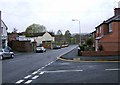
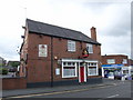
Enville Street (A458)
This is the A458 Stourbridge to Bridgnorth Road. Here is it called Enville Street, but later, as it passes through the Wollaston area, it is known as Bridgnorth Road. On the left can be glimpsed the Wollaston Fish Too shop Image In the far distant on the left are three storey blocks of apartments. All along Enville Street and Bridgnorth Road there is still a generous selection of pubs.
Image: © P L Chadwick
Taken: 9 Apr 2009
0.20 miles
10
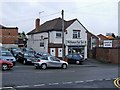
Wollaston Fish Too, 131 Enville Road
It's difficult for a non-local to know where Wollaston, now a suburb of Stourbridge, ends and where Stourbridge proper begins. But this fish & chip etc shop seems to think it is in Wollaston, so presumably this is more or less where Wollaston begins.
Image: © P L Chadwick
Taken: 9 Apr 2009
0.20 miles