
IMAGES TAKEN NEAR TO
High Street, TIPTON, DY4 9JB
Introduction
This page details the photographs taken nearby to High Street, DY4 9JB by members of the Geograph project.
The Geograph project started in 2005 with the aim of publishing, organising and preserving representative images for every square kilometre of Great Britain, Ireland and the Isle of Man.

There are currently over 7.5m images from over14,400 individuals and you can help contribute to the project by visiting https://www.geograph.org.uk
Image Map
Images are licensed for reuse under creativecommons.org/licenses/by-sa/2.0
Notes
- Clicking on the map will re-center to the selected point.
- The higher the marker number, the further away the image location is from the centre of the postcode.
Image Listing (65 Images Found)
Images are licensed for reuse under creativecommons.org/licenses/by-sa/2.0
Image
Details
Distance
1
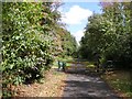
Footpath Gate
The view of the path to Tipton Sports in Princes End.
Image: © Gordon Griffiths
Taken: 16 Aug 2018
0.04 miles
2
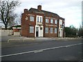
The Shepherd's Cottage pub
With a name like that, they must, surely, have produced the best pies in the Black Country before closing.
Image: © Richard Law
Taken: 4 Dec 2009
0.05 miles
3
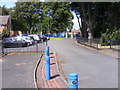
Path into the Playground
The view from High Street in Princes End.
Image: © Gordon Griffiths
Taken: 16 Aug 2018
0.05 miles
4
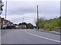
A4037 Bend
The view along the Wednesbury Oak Road in Sandwell.
Image: © Gordon Griffiths
Taken: 11 Aug 2018
0.05 miles
5
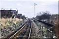
Single track railway at Princes End
An image from 1978 when this railway route through Princes End was still active albeit, only for goods traffic. As a passenger route, according to a Wikipedia entry, traffic ended in 1916. The route now, (2020), seems to be a railway path.
Image: © Trevor Littlewood
Taken: 25 Mar 1978
0.06 miles
6
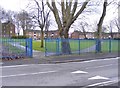
Laybourne Park
The view from Richards Road, Wednesbury Oak, Sandwell.
Image: © Gordon Griffiths
Taken: 30 Mar 2017
0.08 miles
7
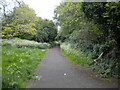
Footpath off Upper Church Lane, Princes End
Using the formation of the former Tipton to Wednesbury railway line, which remained open for freight into the early 1980s. This was the site of Princes End station (closed to passengers as early as 1916); please see Image for a view from the same place in 1978.
Image: © Richard Vince
Taken: 29 May 2021
0.08 miles
8
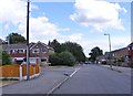
Field Road View
The view in Princes End, Tipton.
Image: © Gordon Griffiths
Taken: 16 Aug 2018
0.08 miles
9
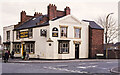
The George and Dragon
The George and Dragon pub in April 1977, at the junction of High Street, (the A4037), and Upper Church Lane in Princes End, a district of Tipton. The pub has gone and in 2020 the site appears to be occupied by a Greggs Bakery outlet.
Image: © Trevor Littlewood
Taken: 8 Apr 1977
0.08 miles
10
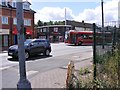
High Street Junction
The view of the junction with Upper Church Lane in Princes End.
Image: © Gordon Griffiths
Taken: 16 Aug 2018
0.09 miles