
IMAGES TAKEN NEAR TO
Victoria Road, TIPTON, DY4 8SW
Introduction
This page details the photographs taken nearby to Victoria Road, DY4 8SW by members of the Geograph project.
The Geograph project started in 2005 with the aim of publishing, organising and preserving representative images for every square kilometre of Great Britain, Ireland and the Isle of Man.

There are currently over 7.5m images from over14,400 individuals and you can help contribute to the project by visiting https://www.geograph.org.uk
Image Map
Images are licensed for reuse under creativecommons.org/licenses/by-sa/2.0
Notes
- Clicking on the map will re-center to the selected point.
- The higher the marker number, the further away the image location is from the centre of the postcode.
Image Listing (39 Images Found)
Images are licensed for reuse under creativecommons.org/licenses/by-sa/2.0
Image
Details
Distance
1
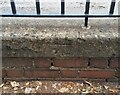
Ordnance Survey Cut Mark
This OS cut mark can be found on the wall of the Sacred Heart School, Victoria Road. It marks a point 137.706m above mean sea level.
Image: © Adrian Dust
Taken: 10 Jul 2021
0.02 miles
2
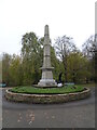
War Memorial
The view in Victoria Park of the Tipton Cenotaph.
Image: © Gordon Griffiths
Taken: 4 Nov 2024
0.07 miles
3
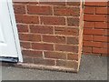
Ordnance Survey Cut Mark
This OS cut mark can be found on No39 Victoria Road. It marks a point 135.167m above mean sea level.
Image: © Adrian Dust
Taken: 10 Jul 2021
0.08 miles
4
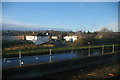
Bath Road, Tipton, from the railway
In the foreground, the Birmingham Canal (New Main Line).
Image: © Christopher Hilton
Taken: 13 Feb 2014
0.08 miles
5
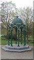
Refurbished water fountain
The water fountain canopy dates from the opening of Victoria Park in 1901 and was presented by Mr and Mrs Waring on the occasion of their golden wedding anniversary.
I was initially puzzled by the inscription 'Keep the pavement dry'.
Image: © John M
Taken: 12 Apr 2009
0.09 miles
6
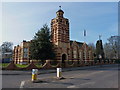
The Carnegie Centre, Tipton
See Image for details of this magnificent building.
Image: © Richard Law
Taken: 31 Jan 2011
0.09 miles
7
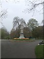
Tipton 'Cenotaph'
The war memorial in Victoria Park was unveiled in 1921.
Image: © John M
Taken: 12 Apr 2009
0.09 miles
8
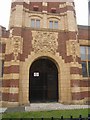
Carnegie Centre - Entrance
Brick and terracotta decoration on the 'Tipton Free Library' building. Image]
Image: © John M
Taken: 12 Apr 2009
0.10 miles
9
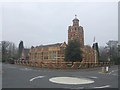
Carnegie Centre
Tipton's original public library building dating from 1906 was funded by Andrew Carnegie. The library moved to a new building in 2000 and the building is now used by Sandwell Council's occupational health unit.
Image: © John M
Taken: 12 Apr 2009
0.11 miles
10
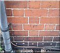
Ordnance Survey Cut Mark
This OS cut mark can be found on The Park PH on Victoria Road. It marks a point 136.011m above mean sea level.
Image: © Adrian Dust
Taken: 10 Jul 2021
0.11 miles