
IMAGES TAKEN NEAR TO
Castle Street, TIPTON, DY4 8HP
Introduction
This page details the photographs taken nearby to Castle Street, DY4 8HP by members of the Geograph project.
The Geograph project started in 2005 with the aim of publishing, organising and preserving representative images for every square kilometre of Great Britain, Ireland and the Isle of Man.

There are currently over 7.5m images from over14,400 individuals and you can help contribute to the project by visiting https://www.geograph.org.uk
Image Map
Images are licensed for reuse under creativecommons.org/licenses/by-sa/2.0
Notes
- Clicking on the map will re-center to the selected point.
- The higher the marker number, the further away the image location is from the centre of the postcode.
Image Listing (123 Images Found)
Images are licensed for reuse under creativecommons.org/licenses/by-sa/2.0
Image
Details
Distance
1
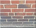
Ordnance Survey Cut Mark
This OS cut mark can be found on the NW face of the Works building which is now a Gym on High Street. It marks a point 145.533m above mean sea level.
Image: © Adrian Dust
Taken: 10 Jul 2021
0.03 miles
2
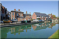
Canalside housing near Tipton Green in Sandwell
This is south-west of Tipton Green Bridge, and is the Birmingham Canal Navigations Old Main Line (Wolverhampton Level), built in 1772 by James Brindley. The modern housing is off Castle Street.
It is noticeable how clear the water is, allowing the bed of the canal to be seen. No doubt this is due to Covid-19 regulations causing the number of passing narrowboats to be very limited.
Image: © Roger Kidd
Taken: 19 Apr 2021
0.03 miles
3
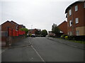
Chapel Street, Tipton
Off High Street.
Image: © Richard Vince
Taken: 29 May 2021
0.04 miles
4
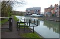
Birmingham Canal Navigations (Old Main Line) in Tipton
Image: © Mat Fascione
Taken: 16 Apr 2017
0.04 miles
5
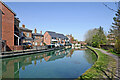
Birmingham Canal Navigations near Tipton Green in Sandwell
Looking north-north-east towards Tipton Green Bridge, this is the meandering Birmingham Canal Navigations Old Main Line (Wolverhampton Level), built in 1772 by James Brindley. The modern housing is off Castle Street.
It is noticeable how clear the water is, allowing the bed of the canal to be seen. No doubt this is due to Covid-19 regulations causing the number of passing narrowboats to be very limited.
Image: © Roger Kidd
Taken: 19 Apr 2021
0.04 miles
6
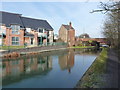
Canalside living - old & new
Two ages of canalside properties just outside Tipton.
Image: © Richard Law
Taken: 31 Jan 2011
0.04 miles
7
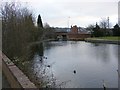
Tipton Canal
The view off Ellott's Road.
Image: © Gordon Griffiths
Taken: 27 Dec 2008
0.05 miles
8
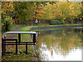
BCN Old Main Line, Tipton
A man walks his dog along the towpath of the BCN (Birmingham Canal Navigations) Old Main Line between Factory Junction and Tipton Junction.
Image: © Stephen McKay
Taken: 17 Oct 2015
0.05 miles
9
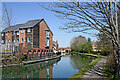
Birmingham Canal Navigations near Tipton Green in Sandwell
Looking north-east towards Tipton Green Bridge, this is the meandering BCN Old Main Line (Wolverhampton Level), built in 1772 by James Brindley. The modern housing is off Castle Street.
Image: © Roger Kidd
Taken: 19 Apr 2021
0.05 miles
10
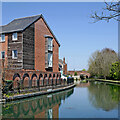
Canalside housing near Tipton Green in Sandwell
Looking north-east towards Tipton Green Bridge, this is the meandering Birmingham Canal Navigations Old Main Line (Wolverhampton Level), built in 1772 by James Brindley. The modern housing is off Castle Street.
Image: © Roger Kidd
Taken: 19 Apr 2021
0.05 miles