
IMAGES TAKEN NEAR TO
Beehive Walk, TIPTON, DY4 8HF
Introduction
This page details the photographs taken nearby to Beehive Walk, DY4 8HF by members of the Geograph project.
The Geograph project started in 2005 with the aim of publishing, organising and preserving representative images for every square kilometre of Great Britain, Ireland and the Isle of Man.

There are currently over 7.5m images from over14,400 individuals and you can help contribute to the project by visiting https://www.geograph.org.uk
Image Map
Images are licensed for reuse under creativecommons.org/licenses/by-sa/2.0
Notes
- Clicking on the map will re-center to the selected point.
- The higher the marker number, the further away the image location is from the centre of the postcode.
Image Listing (134 Images Found)
Images are licensed for reuse under creativecommons.org/licenses/by-sa/2.0
Image
Details
Distance
1

Houses on Beehive Walk, Tipton Green
On the north bank of the BCN's Old Main Line.
Image: © Christine Johnstone
Taken: 10 May 2022
0.01 miles
2
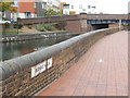
Beehive Walk, Tipton
Beehive Walk offers the opportunity to stroll next to the canal close to Owen Street Bridge.
Image: © Stephen McKay
Taken: 17 Oct 2015
0.02 miles
3
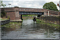
Owen Street Bridge, BCN Old Main Line
This is the last bridge over the Old Main Line before it meets the new line at Factory Junction.
Image: © Stephen McKay
Taken: 8 Aug 2014
0.02 miles
4
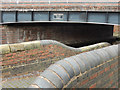
Owen Street Bridge, Tipton
The bridge carries Owen Street over the Old Main Line of the BCN (Birmingham Canal Navigations) system - also known as the Wolverhampton Level (as opposed to the three locks lower Birmingham level).
Image: © Stephen McKay
Taken: 17 Oct 2015
0.02 miles
5
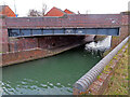
Owen Street Bridge, Tipton
Dated 2002 and crossing part of Birmingham Canal Navigations.
Image: © Chris Allen
Taken: 17 Feb 2023
0.03 miles
6
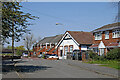
Elliots Road and Beehive Walk at Tipton Green in Sandwell
Looking north from near the canal.
Image: © Roger Kidd
Taken: 19 Apr 2021
0.03 miles
7
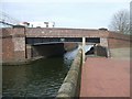
Owen Street Bridge
This bridge was reconstructed in 2002. The white building is the Neptune Health Centre.
Image: © John M
Taken: 11 Mar 2007
0.03 miles
8
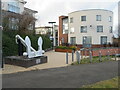
The Tipton Millennium Anchor
Erected in the year 2000 by the Tipton Civic Society to commemorate the chain and anchor industry which existed in Tipton Green from the 1850s to the 1940s. The building in the right background is the Neptune Health Park.
Image: © Chris Allen
Taken: 17 Feb 2023
0.03 miles
9
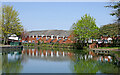
Canal at Tipton Green in Sandwell
Looking north-north-east towards Coseley and Wolverhampton, this is the meandering Birmingham Canal Navigations Old Main Line (Wolverhampton Level), built in 1772 by James Brindley. Tipton Green Bridge is behind the camera. The terraced housing is in Beehive Walk, off New Cross Street.
Image: © Roger Kidd
Taken: 19 Apr 2021
0.04 miles
10
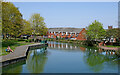
Birmingham Canal Navigations at Tipton Green in Sandwell
Looking north-north-east towards Coseley and Wolverhampton from Tipton Green Bridge, this is the meandering Birmingham Canal Navigations Old Main Line (Wolverhampton Level), built in 1772 by James Brindley.
The terraced housing is in Beehive Walk, off New Cross Street.
On the right is the tower of St Martin's and St Paul's Church, now closed for worship and for sale since 2019.
Image: © Roger Kidd
Taken: 19 Apr 2021
0.04 miles