
IMAGES TAKEN NEAR TO
Coyne Close, TIPTON, DY4 8EL
Introduction
This page details the photographs taken nearby to Coyne Close, DY4 8EL by members of the Geograph project.
The Geograph project started in 2005 with the aim of publishing, organising and preserving representative images for every square kilometre of Great Britain, Ireland and the Isle of Man.

There are currently over 7.5m images from over14,400 individuals and you can help contribute to the project by visiting https://www.geograph.org.uk
Image Map
Images are licensed for reuse under creativecommons.org/licenses/by-sa/2.0
Notes
- Clicking on the map will re-center to the selected point.
- The higher the marker number, the further away the image location is from the centre of the postcode.
Image Listing (109 Images Found)
Images are licensed for reuse under creativecommons.org/licenses/by-sa/2.0
Image
Details
Distance
1
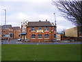
The Pie Factory
Mad O'Rourkes Pub on the Sedgley Road West at Tipton.
Image: © Gordon Griffiths
Taken: 27 Dec 2008
0.04 miles
2
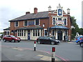
Mad O'Rourke's Pie Factory, Tipton
Down-to-earth boozer with sawdust on the floor, a legendary pie menu and meals served on shovels.
Image: © JThomas
Taken: 22 Aug 2019
0.05 miles
3
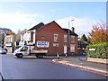
Hurst Lane Junction
The view of the junction with Sedgley Road West in Tipton.
Image: © Gordon Griffiths
Taken: 5 Nov 2017
0.06 miles
4
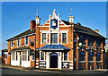
Mad O'Rourke's Pie Factory
A picture from a canal holiday back in the 1990's.
Here is a more recent picture. Image
It doesn't appear to have changed much.
Image: © Des Blenkinsopp
Taken: Unknown
0.07 miles
5
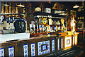
The Bar at Mad O'Rouke's
Inside Mad O'Rourke's Pie Factory back in 1996.
Image
I had their famous Cow Pie which had pastry horns on top.
Image: © Des Blenkinsopp
Taken: Unknown
0.07 miles
6
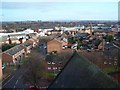
View From The Tower of St Matthew's Church, Tipton
Looking East towards the church of SS Peter & Paul
Image: © Geoff Pick
Taken: 5 Dec 2009
0.08 miles
7
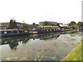
The Busker and Dudley
The view of the narrowboats on the Birmingham Canal in Tipton.
Image: © Gordon Griffiths
Taken: 24 Aug 2016
0.09 miles
8
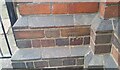
Ordnance Survey Cut Mark
This OS cut mark can be found on the east angle of St Matthews Church on Dudley Road. It marks a point 150.282m above mean sea level.
Image: © Adrian Dust
Taken: 10 Jul 2021
0.09 miles
9
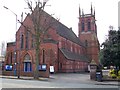
St Matthew C of E Church
Website www.welcome2stmatthews.org.uk
Image: © Stephen Rogerson
Taken: 18 Apr 2013
0.10 miles
10
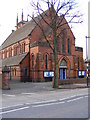
Dudley Road Church
St Matthew's at Tipton.
Image: © Gordon Griffiths
Taken: 27 Dec 2008
0.10 miles