
IMAGES TAKEN NEAR TO
Market Place, TIPTON, DY4 7EJ
Introduction
This page details the photographs taken nearby to Market Place, DY4 7EJ by members of the Geograph project.
The Geograph project started in 2005 with the aim of publishing, organising and preserving representative images for every square kilometre of Great Britain, Ireland and the Isle of Man.

There are currently over 7.5m images from over14,400 individuals and you can help contribute to the project by visiting https://www.geograph.org.uk
Image Map
Images are licensed for reuse under creativecommons.org/licenses/by-sa/2.0
Notes
- Clicking on the map will re-center to the selected point.
- The higher the marker number, the further away the image location is from the centre of the postcode.
Image Listing (34 Images Found)
Images are licensed for reuse under creativecommons.org/licenses/by-sa/2.0
Image
Details
Distance
1
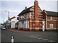
The Nag's Head, Great Bridge
Currently closed, and looking for a new owner by the look of things. A sad indictment of the state of the economy.
Image: © Richard Law
Taken: 4 Dec 2009
0.01 miles
4
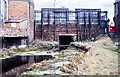
Abandoned canal at Great Bridge, 1979 - 2
The canal was a stretch of the 'Old Wednesbury Canal', part of the Birmingham Canal Navigations. The south side of a bridge is in view; it carries, or its successor carries, the main street through the Great Bridge district of Tipton. It's a desolate scene that only looks worse from the other side of the bridge! - https://www.geograph.org.uk/photo/6734637
Image: © Trevor Littlewood
Taken: 13 Apr 1979
0.07 miles
5
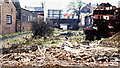
Abandoned canal at Great Bridge, 1979
The canal was a stretch of the 'Old Wednesbury Canal', part of the Birmingham Canal Navigations. The north side of a bridge is in view; it carries, or its successor carries, the main street through the Great Bridge district of Tipton. The camera location is seen to be on a mass of brick rubble; it was the location of another old bridge which had carried a track of the Great Western Railway. That route, as can be seen from OS maps, is now occupied by a new road.
Image: © Trevor Littlewood
Taken: 13 Apr 1979
0.07 miles
8
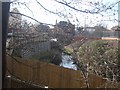
River Tame
The River Tame is a tributary of the River Trent.
Image: © John M
Taken: 21 Feb 2009
0.15 miles

10
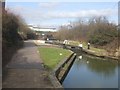
Ryder's Green Locks - Walsall Canal - Bottom Lock
The bottom lock is some distance from the other locks in the eight lock flight.
Image: © John M
Taken: 21 Feb 2009
0.16 miles