IMAGES TAKEN NEAR TO
St. Marks Road, TIPTON, DY4 0ST
Introduction
This page details the photographs taken nearby to St. Marks Road, DY4 0ST by members of the Geograph project.
The Geograph project started in 2005 with the aim of publishing, organising and preserving representative images for every square kilometre of Great Britain, Ireland and the Isle of Man.

There are currently over 7.5m images from over14,400 individuals and you can help contribute to the project by visiting https://www.geograph.org.uk
Image Map
Images are licensed for reuse under creativecommons.org/licenses/by-sa/2.0
Notes
- Clicking on the map will re-center to the selected point.
- The higher the marker number, the further away the image location is from the centre of the postcode.
Image Listing (12 Images Found)
Images are licensed for reuse under creativecommons.org/licenses/by-sa/2.0
Image
Details
Distance
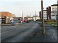
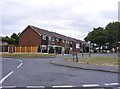
1
St Marks Road View
The view in Tipton, West Midlands.
Image: © Gordon Griffiths
Taken: 3 Aug 2018
0.02 miles
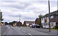
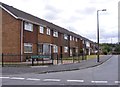
2
Watt Road
The view in Tipton, West Midlands.
Image: © Gordon Griffiths
Taken: 3 Aug 2018
0.05 miles
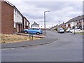
3
Jubilee Road
The view from Highfield Road in Tipton, West Midlands.
Image: © Gordon Griffiths
Taken: 3 Aug 2018
0.09 miles
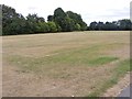
4
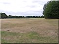
Park View
The view in Jubilee Park Tipton, West Midlands.
Image: © Gordon Griffiths
Taken: 3 Aug 2018
0.09 miles
5
Chaucer Avenue
The view from St Marks Road in Tipton, West Midlands.
Image: © Gordon Griffiths
Taken: 3 Aug 2018
0.10 miles
6
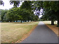
Park Path
The view in Jubilee Park Tipton, West Midlands.
Image: © Gordon Griffiths
Taken: 3 Aug 2018
0.14 miles
7
Park Scene
The view in Jubilee Park Tipton, West Midlands.
Image: © Gordon Griffiths
Taken: 3 Aug 2018
0.15 miles
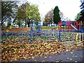
8
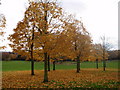
Jubilee Park in Autumn
Jubilee Park taken near Highfield Road, Ocker Hill, entrance.
Image: © M BIRT
Taken: 14 Nov 2008
0.17 miles