IMAGES TAKEN NEAR TO
Arthur Road, TIPTON, DY4 0NN
Introduction
This page details the photographs taken nearby to Arthur Road, DY4 0NN by members of the Geograph project.
The Geograph project started in 2005 with the aim of publishing, organising and preserving representative images for every square kilometre of Great Britain, Ireland and the Isle of Man.

There are currently over 7.5m images from over14,400 individuals and you can help contribute to the project by visiting https://www.geograph.org.uk
Image Map
Images are licensed for reuse under creativecommons.org/licenses/by-sa/2.0
Notes
- Clicking on the map will re-center to the selected point.
- The higher the marker number, the further away the image location is from the centre of the postcode.
Image Listing (16 Images Found)
Images are licensed for reuse under creativecommons.org/licenses/by-sa/2.0
Image
Details
Distance

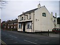
2
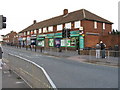
Neighbourhood shops, Church Lane, Tipton
Image: © Peter Whatley
Taken: 22 Oct 2008
0.12 miles
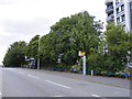
4
Powis Avenue Junction
The view of the junction with Upper Church Lane in Tipton, West Midlands.
Image: © Gordon Griffiths
Taken: 3 Aug 2018
0.12 miles
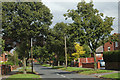
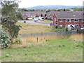
5
Powis Avenue
The view in Tipton, West Midlands.
Image: © Gordon Griffiths
Taken: 3 Aug 2018
0.16 miles
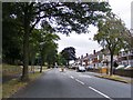
6
Upper Church Lane Scene
The view in Tipton, West Midlands.
Image: © Gordon Griffiths
Taken: 3 Aug 2018
0.18 miles
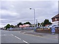
7

Speed humps on Upper Church Lane, Tipton
There are several schools in the immediate vicinity, though parked cars of parents awaiting their children slow everything down at critical times anyway! Warren Close is the street exiting left.
Image: © Peter Whatley
Taken: 22 Oct 2008
0.19 miles
8
Warren Close
The view in Tipton, West Midlands.
Image: © Gordon Griffiths
Taken: 18 Aug 2018
0.20 miles
9
The English Oak, Church Lane, Summerhill
Image: © Richard Law
Taken: 4 Dec 2009
0.20 miles
10
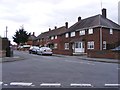
Florence Road
The view in Tipton, West Midlands.
Image: © Gordon Griffiths
Taken: 3 Aug 2018
0.20 miles