
IMAGES TAKEN NEAR TO
Rachel Close, TIPTON, DY4 0EJ
Introduction
This page details the photographs taken nearby to Rachel Close, DY4 0EJ by members of the Geograph project.
The Geograph project started in 2005 with the aim of publishing, organising and preserving representative images for every square kilometre of Great Britain, Ireland and the Isle of Man.

There are currently over 7.5m images from over14,400 individuals and you can help contribute to the project by visiting https://www.geograph.org.uk
Image Map
Images are licensed for reuse under creativecommons.org/licenses/by-sa/2.0
Notes
- Clicking on the map will re-center to the selected point.
- The higher the marker number, the further away the image location is from the centre of the postcode.
Image Listing (7 Images Found)
Images are licensed for reuse under creativecommons.org/licenses/by-sa/2.0
Image
Details
Distance
1
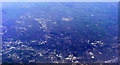
Sandwell and Dudley from the air
Sandwell is in the lower half of the photo, with Dudley beyond. Viewed from a Heathrow bound flight from Glasgow.
Image: © Thomas Nugent
Taken: 10 Apr 2011
0.17 miles
3
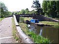
Wiggins Mill Bridge - Walsall Canal
Situated just after a canal basin, this bridge allows the horses that towed narrow boats to cross to the towpath on the other side. Here, British Waterways are carrying out minor repairs to the brickwork.
Image: © Adrian Rothery
Taken: 26 Apr 2007
0.24 miles
4
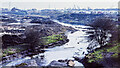
Gospel Oak branch of Walsall Canal, 1979
A truly desolate scene showing the long-abandoned Gospel Oak canal branch from its terminus at Gospel Oak Road. Captain Ahab's website has it that the branch was abandoned in 1954 but still had use as a feeder for the canal system ahead - http://captainahabswaterytales.blogspot.com/2010/12/gospel-oak-branch-bcn-upper-reaches.html.
The scene is entirely different now; the post-industrial waste ground has been developed for housing and the canal route adapted to become a linear park and footpath. The northern end of the branch still has a stretch of water at its junction with the Walsall Canal, as Richard Vince's image shows - https://www.geograph.org.uk/photo/6392737.
Image: © Trevor Littlewood
Taken: 14 Apr 1979
0.24 miles
5
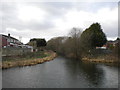
Gospel Oak Branch Junction, Walsall Canal
Looking along the short section of the branch that is still in water.
Image: © Richard Vince
Taken: 1 Feb 2020
0.25 miles
6
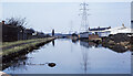
Walsall Canal heading towards Wiggins Mill Bridge in 1979
The Walsall Canal heading north-north-west from beside the bridge carrying the A4037, Leabrook Road. Wiggins Mill Bridge can be seen in the distance.
Image: © Trevor Littlewood
Taken: 14 Apr 1979
0.25 miles
7
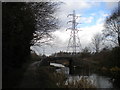
Walsall Canal approaching Wiggins Mill Bridge, Wednesbury
The turnover bridge is dwarfed by a magnificent pylon, silhouetted against an uncertain sky.
Image: © Richard Vince
Taken: 1 Feb 2020
0.25 miles