
IMAGES TAKEN NEAR TO
Vale Street, DUDLEY, DY3 3XF
Introduction
This page details the photographs taken nearby to Vale Street, DY3 3XF by members of the Geograph project.
The Geograph project started in 2005 with the aim of publishing, organising and preserving representative images for every square kilometre of Great Britain, Ireland and the Isle of Man.

There are currently over 7.5m images from over14,400 individuals and you can help contribute to the project by visiting https://www.geograph.org.uk
Image Map
Images are licensed for reuse under creativecommons.org/licenses/by-sa/2.0
Notes
- Clicking on the map will re-center to the selected point.
- The higher the marker number, the further away the image location is from the centre of the postcode.
Image Listing (114 Images Found)
Images are licensed for reuse under creativecommons.org/licenses/by-sa/2.0
Image
Details
Distance
1

Ruiton Windmill
This disused windmill in Upper Gornal,Dudley is now used by Youth Groups.
Image: © Gordon Griffiths
Taken: 21 Mar 2007
0.03 miles
2
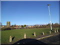
Park View
The view of the Ruiton playing field and Windmill in Upper Gornal, Dudley.
Image: © Gordon Griffiths
Taken: 11 Jan 2014
0.06 miles
3
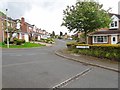
Old Quarry Drive View
The view up Botany Drive in Ruiton, Sedgley.
Image: © Gordon Griffiths
Taken: 28 May 2019
0.06 miles
4
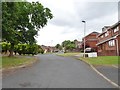
Botany Drive View
The view in Ruiton, Sedgley.
Image: © Gordon Griffiths
Taken: 30 May 2019
0.07 miles
5
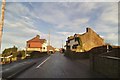
Vale Row View
The view up Vale Street in Ruiton, Dudley.
Image: © Gordon Griffiths
Taken: 15 Jan 2014
0.07 miles
6
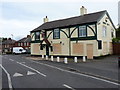
The Good Intent
Seems to have lost its intent to trade, sadly, since Image was taken.
Image: © Richard Law
Taken: 9 Sep 2011
0.08 miles
7
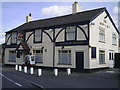
The Good Intent
A pub in Vale Street.
Image: © Gordon Griffiths
Taken: 21 Jun 2006
0.09 miles
8
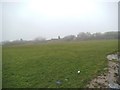
Ruiton Fields View
The view of the playing field in Upper Gornal, Dudley.
Image: © Gordon Griffiths
Taken: 4 Jan 2014
0.09 miles
9
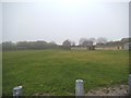
Ruiton Fields
The view of the playing fields off Vale Street in Upper Gornal, Dudley.
Image: © Gordon Griffiths
Taken: 4 Jan 2014
0.09 miles
10
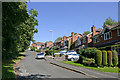
Old Quarry Drive near Ruiton, Dudley
Looking north-north-east towards Botany Drive. Cotwall End Nature Reserve is off to the left.
Harper's Quarry was here before the houses were built. It extracted the Devonian Sandstone which was used extensively to build local churches and houses. This yellow stone is particularly hard.
Image: © Roger Kidd
Taken: 14 Sep 2020
0.10 miles