
IMAGES TAKEN NEAR TO
Walnut Grove, STOURPORT-ON-SEVERN, DY13 9NT
Introduction
This page details the photographs taken nearby to Walnut Grove, DY13 9NT by members of the Geograph project.
The Geograph project started in 2005 with the aim of publishing, organising and preserving representative images for every square kilometre of Great Britain, Ireland and the Isle of Man.

There are currently over 7.5m images from over14,400 individuals and you can help contribute to the project by visiting https://www.geograph.org.uk
Image Map
Images are licensed for reuse under creativecommons.org/licenses/by-sa/2.0
Notes
- Clicking on the map will re-center to the selected point.
- The higher the marker number, the further away the image location is from the centre of the postcode.
Image Listing (75 Images Found)
Images are licensed for reuse under creativecommons.org/licenses/by-sa/2.0
Image
Details
Distance
1
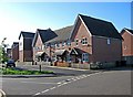
Modern housing in The Osiers
The Osiers is a modern development of flats and town houses, off Mill Road.
Image: © P L Chadwick
Taken: 16 Oct 2010
0.04 miles
2
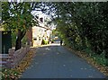
Mill Road
Another view of this old part of Stourport-on-Severn.
Image: © P L Chadwick
Taken: 16 Oct 2010
0.06 miles
3
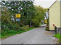
Mill Road due for closure (2)
The yellow sign warns that the road is to be permanently closed, and work will start in November 2010. Undoubtedly pedestrians and cyclists will still be allowed to continue to use this route, as happened in Timber Lane, when that was closed to motorised vehicles by the canal bridge.
Image
The road has now been closed. See:- Image
Image: © P L Chadwick
Taken: 31 Oct 2010
0.06 miles
4
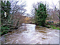
River Stour, Mill Road, looking south
The River Stour is flowing fairly fast at this point. Surface water also drains into it near this point which increases the flow. Typically for this river around Stourport, some detritus can be seen adorning the tree branch on the left of the picture. Further views of this river can be seen on Image and Image, and
Image
Image: © P L Chadwick
Taken: 13 Jan 2008
0.06 miles
5
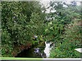
River Stour near Millfields Drive
Stourport's "other river" is very discreet and not often seen, as it meanders its way through the town, on its journey to meet the River Severn. Look carefully, and you can see an angler on the left bank.
Image: © P L Chadwick
Taken: 19 Sep 2010
0.07 miles
6
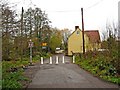
Mill Road closure (2)
The road has now been closed to through traffic in respect of motor vehicles and motorbikes. There is only this one barrier and strangely, although there are red reflectors on the other side of the posts, there are none on this side. Maybe these will follow shortly.
Image
Image: © P L Chadwick
Taken: 20 Nov 2010
0.07 miles
7
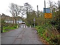
Mill Road closure (1)
Mill Road has now been closed to through traffic in respect of motor vehicles and motorbikes. Pedestrians and cyclists can pass through the new barrier. Image
See also:- Image
Image: © P L Chadwick
Taken: 20 Nov 2010
0.07 miles
8
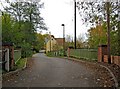
Mill Road due for closure (1)
A sign has appeared announcing that work will commence in November 2010 to close this road. The green railings mark the point where the road crosses the River Stour. The barrier or gate will be somewhere around here. See also:- Image
The road has now been closed. See:- Image
Image: © P L Chadwick
Taken: 31 Oct 2010
0.07 miles
9
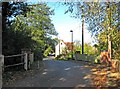
Mill Road crossing the River Stour
The green painted railings, on both sides of the road, indicate the point where the River Stour passes under the road.
Image: © P L Chadwick
Taken: 16 Oct 2010
0.07 miles
10

Stile, Mill Road
The stile gives access to a footpath, which runs alongside the River Stour for a short distance. The footpath is not much used.
Image: © P L Chadwick
Taken: 16 Oct 2010
0.08 miles