
IMAGES TAKEN NEAR TO
Malham Road, STOURPORT-ON-SEVERN, DY13 8NT
Introduction
This page details the photographs taken nearby to Malham Road, DY13 8NT by members of the Geograph project.
The Geograph project started in 2005 with the aim of publishing, organising and preserving representative images for every square kilometre of Great Britain, Ireland and the Isle of Man.

There are currently over 7.5m images from over14,400 individuals and you can help contribute to the project by visiting https://www.geograph.org.uk
Image Map
Images are licensed for reuse under creativecommons.org/licenses/by-sa/2.0
Notes
- Clicking on the map will re-center to the selected point.
- The higher the marker number, the further away the image location is from the centre of the postcode.
Image Listing (16 Images Found)
Images are licensed for reuse under creativecommons.org/licenses/by-sa/2.0
Image
Details
Distance
1
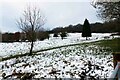
Snow on former golf course, Stourport-on-Severn, Worcs
The Burlish Park Golf Club & Course closed in 2018. It is now in the process of being converted into a nature reserve. 18,000 trees will be planted as part of this scheme, which will have a beneficial effect on the climate.
Image: © P L Chadwick
Taken: 1 Jan 2021
0.18 miles
2
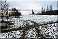
New Year's Day 2021 - snow on former golf course, Stourport-on-Severn, Worcs
Much of the former Burlish Park Golf Course is currently used as a public green space. On New Year's Day much of it was still covered with snow, although it had gone from the trees.
Image: © P L Chadwick
Taken: 1 Jan 2021
0.18 miles
3
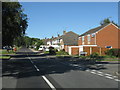
Stourport - Burlish Crossing at Windermere Way
Image: © Peter Whatley
Taken: 21 Jun 2010
0.20 miles
5
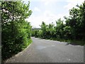
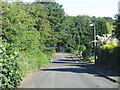
Kingsway near entrance to former US Army Camp, near Stourport-on-Severn
The former entrance to the long demolished US Army Camp (Camp Bewdley No. 2) was just to the left of the photographer's position. See:- Image The road in this direction is heading towards its junction with the A451 Kidderminster to Stourport-on-Severn road.
Image: © P L Chadwick
Taken: 26 Apr 2014
0.21 miles
7
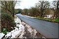
Kingsway by former golf course, Stourport-on-Severn, Worcs
The road actually runs between two parts of the former Burlish Park Golf Course. This closed in 2018 and the land is being developed as a nature reserve.
Image: © P L Chadwick
Taken: 1 Jan 2021
0.21 miles
8
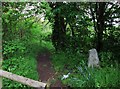
Footpath from Kingsway to Burlish Top Nature Reserve, near Stourport-on-Severn
This short footpath connects with another, which leads to the nature reserve. The latter path is part of the footpath known as the Geopark Way and is also part of the Stourport Circular Walk.
For more about the concrete marker post, please see:- Image
Image: © P L Chadwick
Taken: 26 Apr 2014
0.21 miles
9
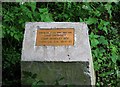
Plaque marking former entrance to Camp Bewdley No. 2, Burlish Top, near Stourport-on-Severn
During the second half of the Second World War, the US Army had an army training and hospital camp at Burlish Top. Very little now remains, other than a few deteriorating concrete paths and some building foundations and at least one length of low wall. Since 1994 the area has been a nature reserve but recently several of these plaques were installed marking various points of interest. This one marks the entrance, off Kingsway, to the camp known apparently as Camp Bewdley No. 2. Camp No. 1 nearby is now the site of housing estates. Sadly a large number of the troops who were here died on the landing beaches at Omaha (Normandy, France) in June 1944.
The text reads, "Burlish Camp US Army 1943-1945. Camp Entrance. Camp Bewdley No. 2. 114th U.S. G.H. 1944-45." The former entrance can be seen here, although now it is just a path:- Image
Image: © P L Chadwick
Taken: 26 Apr 2014
0.21 miles
10
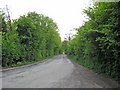
Kingsway
Further along this road the residential area of Stourport-on-Severn begins.
Image: © P L Chadwick
Taken: 7 May 2010
0.22 miles