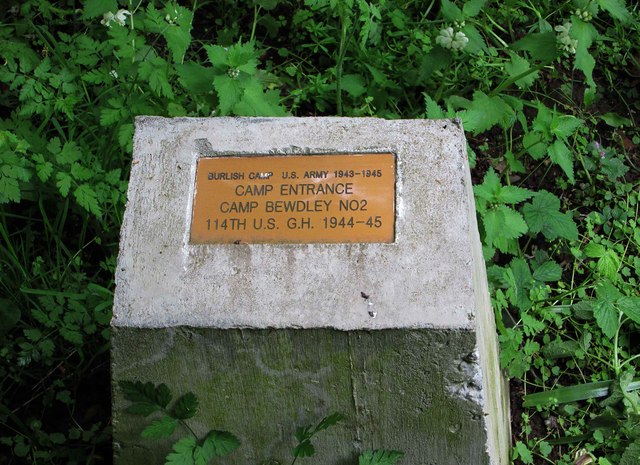
Plaque marking former entrance to Camp Bewdley No. 2, Burlish Top, near Stourport-on-Severn
Introduction
The photograph on this page of Plaque marking former entrance to Camp Bewdley No. 2, Burlish Top, near Stourport-on-Severn by P L Chadwick as part of the Geograph project.
The Geograph project started in 2005 with the aim of publishing, organising and preserving representative images for every square kilometre of Great Britain, Ireland and the Isle of Man.
There are currently over 7.5m images from over 14,400 individuals and you can help contribute to the project by visiting https://www.geograph.org.uk

Image: © P L Chadwick Taken: 26 Apr 2014
During the second half of the Second World War, the US Army had an army training and hospital camp at Burlish Top. Very little now remains, other than a few deteriorating concrete paths and some building foundations and at least one length of low wall. Since 1994 the area has been a nature reserve but recently several of these plaques were installed marking various points of interest. This one marks the entrance, off Kingsway, to the camp known apparently as Camp Bewdley No. 2. Camp No. 1 nearby is now the site of housing estates. Sadly a large number of the troops who were here died on the landing beaches at Omaha (Normandy, France) in June 1944. The text reads, "Burlish Camp US Army 1943-1945. Camp Entrance. Camp Bewdley No. 2. 114th U.S. G.H. 1944-45." The former entrance can be seen here, although now it is just a path:- Image

