
IMAGES TAKEN NEAR TO
Worcester Street, STOURPORT-ON-SEVERN, DY13 8EH
Introduction
This page details the photographs taken nearby to Worcester Street, DY13 8EH by members of the Geograph project.
The Geograph project started in 2005 with the aim of publishing, organising and preserving representative images for every square kilometre of Great Britain, Ireland and the Isle of Man.

There are currently over 7.5m images from over14,400 individuals and you can help contribute to the project by visiting https://www.geograph.org.uk
Image Map
Images are licensed for reuse under creativecommons.org/licenses/by-sa/2.0
Notes
- Clicking on the map will re-center to the selected point.
- The higher the marker number, the further away the image location is from the centre of the postcode.
Image Listing (276 Images Found)
Images are licensed for reuse under creativecommons.org/licenses/by-sa/2.0
Image
Details
Distance
1
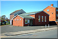
Christadelphian Hall, Bewdley Road, Stourport-on-Severn
The building, which was at one time the former Old Parish Room, is used by Stourport Christadelphians for worship. The Christadelphians are a Christian group, although not generally regarded as a mainstream one. For example, they do not believe in the Trinity, do not vote in elections and believe that members should only marry other members.
Image: © P L Chadwick
Taken: 14 Apr 2015
0.05 miles
3

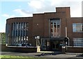
Stourport fire station
Stourport fire station, Foundry Street, Stourport, Worcestershire, forms part of the Hereford & Worcester Fire & Rescue Service.
Image: © Kevin Hale
Taken: 21 Oct 2006
0.06 miles
4
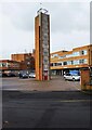
The former Stourport Fire Station (2) - drill tower, Foundry Street, Stourport-on-Severn, Worcs
This is the former drill tower, which is behind the now closed fire station. It is difficult to imagine a future use for this structure.
Image
Image: © P L Chadwick
Taken: 21 Feb 2021
0.06 miles
5
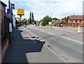
Speed camera along the northbound A451
Image: © Mat Fascione
Taken: 28 Jul 2013
0.06 miles
6
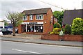
Chloe L'Enfant Salon, 5 Bewdley Road, Stourport-on-Severn
A hair and beauty salon.
Update February 2021:- The business here is now Son of a Bleach. Image
Image: © P L Chadwick
Taken: 3 Aug 2017
0.06 miles
7
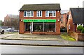
Son of a Bleach, 5 Bewdley Road, Stourport-on-Severn, Worcs
It describes itself as an alternative hair salon. Previously the business here was Chloe L'Enfant Salon. Image
Image: © P L Chadwick
Taken: 21 Feb 2021
0.06 miles
8
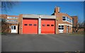
Stourport Fire Station, Foundry Street, Stourport-on-Severn
The fire station forms part of a complex of buildings known as County Buildings. They were built in 1970-72 on the site of a demolished foundry, and designed by Worcestershire County Council's Architects' Department. The fire station is located on the corner of Bewdley Road and Foundry Street. It is operated by Hereford & Worcester Fire & Rescue service as an on-call station. Based there are a Dennis Sabre Fire Engine and an Environment Protection Unit (EPU).
Update (December 2020): This station closed in early 2020 when a new station was opened in Stourport Road Kidderminster serving all of the Wyre Forest area.
Image: © P L Chadwick
Taken: 14 Apr 2015
0.07 miles
9
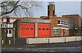
The former Stourport Fire Station (1), Foundry Street, Stourport-on-Severn, Worcs
The fire station closed a year ago in February 2020. The station was relocated into a new hub in Stourport Road Kidderminster, which also serves the rest of the Wyre Forest District. Since the closure, large concrete blocks have been put in place to block access to the car park.
Image
Image
Image: © P L Chadwick
Taken: 21 Feb 2021
0.07 miles
10

Foundry Street, Stourport-on-Severn
Named after Baldwin's Foundry, which used to stand on the left, where the County Buildings now are. The Company's former warehouse survives and is the three storey building in this view.
Image: © P L Chadwick
Taken: 15 Jul 2012
0.07 miles