The former Stourport Fire Station (1), Foundry Street, Stourport-on-Severn, Worcs
Introduction
The photograph on this page of The former Stourport Fire Station (1), Foundry Street, Stourport-on-Severn, Worcs by P L Chadwick as part of the Geograph project.
The Geograph project started in 2005 with the aim of publishing, organising and preserving representative images for every square kilometre of Great Britain, Ireland and the Isle of Man.

There are currently over 7.5m images from over 14,400 individuals and you can help contribute to the project by visiting https://www.geograph.org.uk
The former Stourport Fire Station (1), Foundry Street, Stourport-on-Severn, Worcs
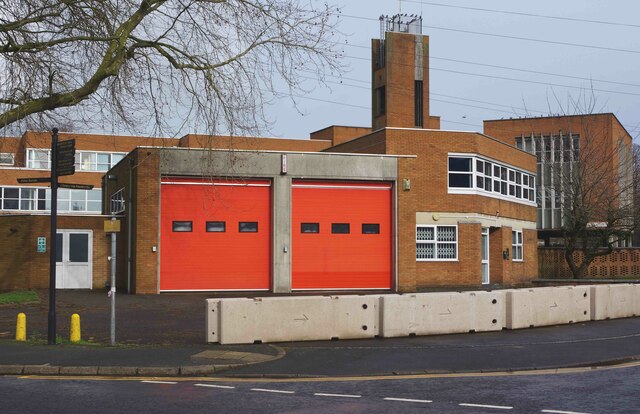
Image: © P L Chadwick Taken: 21 Feb 2021
The fire station closed a year ago in February 2020. The station was relocated into a new hub in Stourport Road Kidderminster, which also serves the rest of the Wyre Forest District. Since the closure, large concrete blocks have been put in place to block access to the car park. Image Image
Images are licensed for reuse under creativecommons.org/licenses/by-sa/2.0
Image Location
Latitude
52.34287
Longitude
-2.27738