
IMAGES TAKEN NEAR TO
Trevithick Close, STOURPORT-ON-SEVERN, DY13 8AN
Introduction
This page details the photographs taken nearby to Trevithick Close, DY13 8AN by members of the Geograph project.
The Geograph project started in 2005 with the aim of publishing, organising and preserving representative images for every square kilometre of Great Britain, Ireland and the Isle of Man.

There are currently over 7.5m images from over14,400 individuals and you can help contribute to the project by visiting https://www.geograph.org.uk
Image Map
Images are licensed for reuse under creativecommons.org/licenses/by-sa/2.0
Notes
- Clicking on the map will re-center to the selected point.
- The higher the marker number, the further away the image location is from the centre of the postcode.
Image Listing (118 Images Found)
Images are licensed for reuse under creativecommons.org/licenses/by-sa/2.0
Image
Details
Distance
1
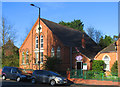
Stourport Baptist Church (3) - Church schoolroom, Minster Road, Stourport-on-Severn
The schoolroom was built next to the church in 1896. It is well used during the week both for church activities and by local community groups.
Other photos, please see:- Image
Image: © P L Chadwick
Taken: 23 Apr 2013
0.05 miles
2
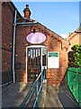
Stourport Baptist Church (4) - Church schoolroom entrance, Minster Road, Stourport-on-Severn
Other photos, please see:- Image
Image: © P L Chadwick
Taken: 23 Apr 2013
0.06 miles
3
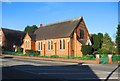
Stourport Baptist Church (1), Minster Road, Stourport-on-Severn
The church is on the corner of Minster Road (the A451) and Prospect Road. Designed by Ingall & Hughes and built in 1883. The church normally has two services on Sundays, and organises many activities in the week, both in the church and elsewhere.
Image
Image
Image
Image: © P L Chadwick
Taken: 23 Apr 2013
0.06 miles
4
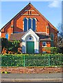
Stourport Baptist Church (2) - Prospect Road entrance, Stourport-on-Severn
The south side of the church and entrance, seen from Prospect Road.
Other photos, please see:- Image
Image: © P L Chadwick
Taken: 23 Apr 2013
0.06 miles
6
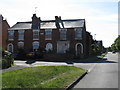
Stourport - Warwick Road from Windermere Way
Image: © Peter Whatley
Taken: 21 Jun 2010
0.12 miles
7
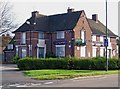
The closed New Manor public house, 76 Minster Road
Another Stourport pub bites the dust. This one was photographed in November 2009 but closed some weeks earlier. All the windows and doors are covered in metal sheeting, and it bears a "For Sale" sign. It would be nice to see this one re-open, but at the current asking price of £445,000 for the freehold, you would need to feel pretty confident you could make a go of it. The agents say that it possibly could be used for something else, subject to planning permission. For a picture of the pub when open please see:- Image
Update (October 2011):- The pub was recently demolished. See:- Image
Image: © P L Chadwick
Taken: 1 Nov 2009
0.13 miles
9
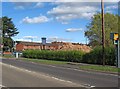
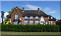
Site of the former New Manor, 76 Minster Road, Stourport-on-Severn
Blink an eye, and another public house in the Wyre Forest District has been closed or demolished. Behind the hedge is the site of the former New Manor pub, recently demolished. The pile of rubble was the pub building. The contractors haven't yet got around to the sign, which still remains on its post.
More photos:- Image, and Image
Image: © P L Chadwick
Taken: 16 Oct 2011
0.13 miles
10
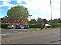
Site of the former New Manor, 76 Minster Road, Stourport-on-Severn
Just the pub sign, and this pile of rubble, remain from the former New Manor public house. For more information see Image, and Image
Image: © P L Chadwick
Taken: 16 Oct 2011
0.13 miles