
IMAGES TAKEN NEAR TO
Prince Rupert Road, STOURPORT-ON-SEVERN, DY13 0AS
Introduction
This page details the photographs taken nearby to Prince Rupert Road, DY13 0AS by members of the Geograph project.
The Geograph project started in 2005 with the aim of publishing, organising and preserving representative images for every square kilometre of Great Britain, Ireland and the Isle of Man.

There are currently over 7.5m images from over14,400 individuals and you can help contribute to the project by visiting https://www.geograph.org.uk
Image Map
Images are licensed for reuse under creativecommons.org/licenses/by-sa/2.0
Notes
- Clicking on the map will re-center to the selected point.
- The higher the marker number, the further away the image location is from the centre of the postcode.
Image Listing (69 Images Found)
Images are licensed for reuse under creativecommons.org/licenses/by-sa/2.0
Image
Details
Distance
1

Areley Lane, Stourport-on-Severn
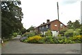
Areley Lane is seen here heading out into the countryside, where it shortly joins the B4194 Stourport-on-Severn to Bewdley road. On the right is the start of a private road, which gives access to a number of houses. There is a public bridleway along this, which comes out by the River Severn, near to Stourport Bridge.
Image: © P L Chadwick
Taken: 19 Feb 2012
0.11 miles
3
Areley Lane, Stourport-on-Severn
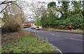
There are only a few houses along this road, which soon leaves the town behind and enters the countryside. For details of the postbox please see:- Image
Image: © P L Chadwick
Taken: 19 Feb 2012
0.12 miles
4
Betty Dawes Hill, Stourport-on-Severn
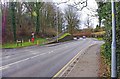
The road coming in on the left is called The Rough. The section of the main road ahead is called Betty Dawes Hill. It is part of the A451 road. The road on the right is Areley Lane.
Image: © P L Chadwick
Taken: 19 Feb 2012
0.13 miles
5
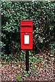
Elizabeth II post-mounted postbox, Areley Lane, Stourport-on-Severn
Located near the junction with the A451 road. See also:- Image
Postbox number:- DY13 83; post code:- DY13 O**. Last collection:- 5 pm Monday to Friday; 10.45 am Saturday.
Image: © P L Chadwick
Taken: 19 Feb 2012
0.13 miles
6
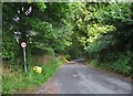
Rectory Lane, Areley Kings, Worcs
The road is descending to its junction with Areley Lane. This is the oldest part of Areley Kings, which used to be a separate village but is now part of the town of Stourport-on-Severn. The name is used also for the new estates to the east of the original village, which are also on this side of the River Severn. The area known as Areley Kings forms two of the wards of the Stourport-on-Severn Town Council.
Image: © P L Chadwick
Taken: 25 Aug 2013
0.13 miles
7
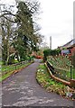
Lane off Areley Lane, Stourport-on-Severn
A private road giving access to various properties. There is a public bridleway running along it which gives access to the River Severn, near Stourport Bridge.
Image: © P L Chadwick
Taken: 19 Feb 2012
0.13 miles
8
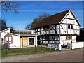
Church House, Areley Kings
A historic half-timbered building adjoining St. Bartholomew's Church. A history of the building can be found at: http://www.churchhouseareleykings.org.uk/3.html
Image: © Geoff Pick
Taken: 21 Feb 2009
0.14 miles
9
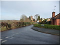
Junction of Church Walk and Rectory Lane, Areley Kings, Stourport-on-Severn
The western fringe of the town's suburbs here with a nice view to Areley Kings church.
Image: © Jeremy Bolwell
Taken: 17 Dec 2012
0.14 miles
10
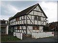
Church House, Areley Kings, Worcestershire
The Church House is a black and white building near the gate leading to St Bartholomew’s Church. It was built in 1536 as a village hall where ‘Church Ales’ and fund raising parties were held until banned by the Puritans in the 1650’s. This is only one of two surviving church houses in Worcestershire.
Image: © Richard Rogerson
Taken: 8 Apr 2011
0.14 miles