
IMAGES TAKEN NEAR TO
Lisle Avenue, KIDDERMINSTER, DY11 7DL
Introduction
This page details the photographs taken nearby to Lisle Avenue, DY11 7DL by members of the Geograph project.
The Geograph project started in 2005 with the aim of publishing, organising and preserving representative images for every square kilometre of Great Britain, Ireland and the Isle of Man.

There are currently over 7.5m images from over14,400 individuals and you can help contribute to the project by visiting https://www.geograph.org.uk
Image Map
Images are licensed for reuse under creativecommons.org/licenses/by-sa/2.0
Notes
- Clicking on the map will re-center to the selected point.
- The higher the marker number, the further away the image location is from the centre of the postcode.
Image Listing (100 Images Found)
Images are licensed for reuse under creativecommons.org/licenses/by-sa/2.0
Image
Details
Distance
1

Lorry Yard
A commercial yard for parking vehicles off Lisle Avenue.
Taken from the Severn Valley Railway.
Image: © David P Howard
Taken: 15 May 2014
0.02 miles
2
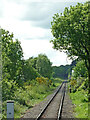
Railway near Foley Park in Kidderminster, Worcestershire
This is the Severn Valley Railway near Foley Park and looking south-west towards Bewdlwy and Bridgnorth. https://svr.co.uk/
Image: © Roger Kidd
Taken: 14 May 2014
0.04 miles
4
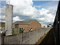
Entering Kidderminster
Taken from the Severn Valley Railway.
Image: © Ian S
Taken: 17 Sep 2011
0.08 miles
5
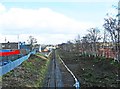
Severn Valley Railway line near Stourport Road, Kidderminster
Viewed from the bridge over the railway line in Stourport Road (the A451), the line is seen here heading for its terminus at Kidderminster, next to the Network Rail station.
Image
Image: © P L Chadwick
Taken: 18 Mar 2013
0.10 miles
6
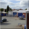
Industrial units near Kidderminster, Worcestershire
This is at Foley Park, and seen looking down from a passing Severn Valley Railway train.
Image: © Roger D Kidd
Taken: 31 May 2015
0.10 miles
7
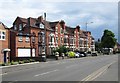
Terrace of housing, Stourport Road, Kidderminster
Stourport Road has a wide variety of housing types along its considerable length. This terrace is still mainly but not exclusively in residential use. Its ends on the corner of Beauchamp Avenue.
Image: © P L Chadwick
Taken: 8 Jun 2014
0.12 miles
8
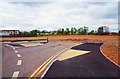
Future road off roundabout, Silverwoods Way, Kidderminster, Worcs
A future road will lead off here once this part of the former British Sugar Corporation site is under redevelopment.
Image
Image
Image: © P L Chadwick
Taken: 16 Apr 2017
0.12 miles
9
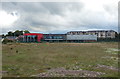
Wyre Forest Leisure Centre
Along Silverwoods Way in Kidderminster, it has been built on the site of the former British Sugar factory, which closed in 2004.
Image: © Mat Fascione
Taken: 30 Jun 2020
0.13 miles
10
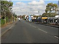
Stourport Road from the railway bridge crest
Image: © Peter Whatley
Taken: 26 Oct 2011
0.13 miles