
IMAGES TAKEN NEAR TO
Salisbury Drive, KIDDERMINSTER, DY11 6HE
Introduction
This page details the photographs taken nearby to Salisbury Drive, DY11 6HE by members of the Geograph project.
The Geograph project started in 2005 with the aim of publishing, organising and preserving representative images for every square kilometre of Great Britain, Ireland and the Isle of Man.

There are currently over 7.5m images from over14,400 individuals and you can help contribute to the project by visiting https://www.geograph.org.uk
Image Map
Images are licensed for reuse under creativecommons.org/licenses/by-sa/2.0
Notes
- Clicking on the map will re-center to the selected point.
- The higher the marker number, the further away the image location is from the centre of the postcode.
Image Listing (28 Images Found)
Images are licensed for reuse under creativecommons.org/licenses/by-sa/2.0
Image
Details
Distance
2
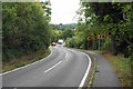
Habberley Road
A brief descent on the way to Bewdley.
Image: © Bill Boaden
Taken: 14 Sep 2018
0.14 miles
3
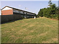
Trig on the Lawn
This trig point is used by local children as a focal point for their play.
Image: © Michael Patterson
Taken: 12 Jul 2006
0.14 miles
4

Trig point at Habberley, Kidderminster
On a small green next to the Habberley Road, 81 metres above sea level.
Image: © Mat Fascione
Taken: 24 Feb 2017
0.15 miles
5
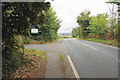
Bridleway off Habberley Road
The track left leads to High Habberley and Low Habberley. This is the highest point on this route of the ridge between Kidderminster and Bewdley.
Image: © Bill Boaden
Taken: 14 Sep 2018
0.17 miles
6
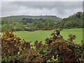
Grassland and woodland near Habberley Valley
Image: © Mat Fascione
Taken: 6 May 2023
0.17 miles
7
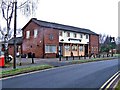
The Coopers Arms (1), Canterbury Road, Kidderminster
A typical modern estate pub, The Coopers Arms serves the Habberley Estate on the edge of Kidderminster. Its claim to fame is that apparently here in July 1965 there was a crucial meeting of a group of people who were to go on and buy the railway line from British Railways that is today the highly successful Severn Valley Railway.
Update July 2019: sadly this pub closed some time ago, the intention being to demolish and replace with housing.
Image
Image
Image: © P L Chadwick
Taken: 1 Jan 2009
0.18 miles
8
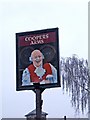
The Coopers Arms (3) - sign, Canterbury Road, Kidderminster
Looking like a character from an 18th century print this cooper may be, but the pub is decidedly mid-20th century. At the bottom of the picture, in the background, can be seen the top of the Italianate tower of the nearby Catholic church Image
Update July 2019 - the pub has permanently closed.
Image
Image
.
Image: © P L Chadwick
Taken: 1 Jan 2009
0.18 miles
9
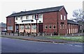
The Coopers Arms (2), Canterbury Road, Kidderminster
Serving Kidderminster's Habberley Estate, The Coopers Arms is on the corner of Canterbury Road and Truro Drive. The big notice hanging on the front of the building proclaims that the pub is under new management. For the pub's claim to fame in railway history see Image
Update July 2019: the pub has permanently closed. For details see link above.
Image
Image: © P L Chadwick
Taken: 1 Jan 2009
0.18 miles
10
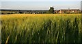
Farmland at High Habberley
This farmland is on the northwest edge of Kidderminster.
Image: © Mat Fascione
Taken: 3 Jul 2019
0.19 miles