IMAGES TAKEN NEAR TO
Blakeshall, KIDDERMINSTER, DY11 5XP
Introduction
This page details the photographs taken nearby to Blakeshall, DY11 5XP by members of the Geograph project.
The Geograph project started in 2005 with the aim of publishing, organising and preserving representative images for every square kilometre of Great Britain, Ireland and the Isle of Man.

There are currently over 7.5m images from over14,400 individuals and you can help contribute to the project by visiting https://www.geograph.org.uk
Image Map
Images are licensed for reuse under creativecommons.org/licenses/by-sa/2.0
Notes
- Clicking on the map will re-center to the selected point.
- The higher the marker number, the further away the image location is from the centre of the postcode.
Image Listing (27 Images Found)
Images are licensed for reuse under creativecommons.org/licenses/by-sa/2.0
Image
Details
Distance
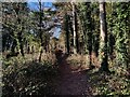
1
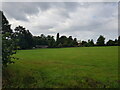
Looking across fields to Blakeshall Hall
Image: © Jeff Gogarty
Taken: 16 Sep 2021
0.05 miles
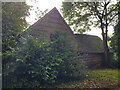
3
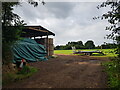
Well ventilated farm building, Jennings Farm
Image: © Jeff Gogarty
Taken: 16 Feb 2023
0.11 miles
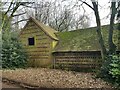
5
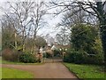
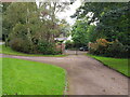
Entrance to Jennings Farm (2)
The trees showing a different season to Image
Image: © Jeff Gogarty
Taken: 16 Feb 2023
0.13 miles
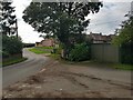
7
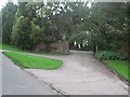
Entrance to Jennings Farm, Blakeshall
Image: © Neal Richardson
Taken: 1 May 1998
0.14 miles
9
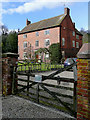
Farm house at Blakeshall, Worcestershire
This is Sebright Farm on the lane to Caunsall and Cookley. Information about the Sebrights can be seen here: http://www.sebrights.org.uk/about/william-sebright.html
Image: © Roger D Kidd
Taken: 15 Mar 2010
0.17 miles