
IMAGES TAKEN NEAR TO
Birds Barn Lane, KIDDERMINSTER, DY11 5SG
Introduction
This page details the photographs taken nearby to Birds Barn Lane, DY11 5SG by members of the Geograph project.
The Geograph project started in 2005 with the aim of publishing, organising and preserving representative images for every square kilometre of Great Britain, Ireland and the Isle of Man.

There are currently over 7.5m images from over14,400 individuals and you can help contribute to the project by visiting https://www.geograph.org.uk
Image Map
Images are licensed for reuse under creativecommons.org/licenses/by-sa/2.0
Notes
- Clicking on the map will re-center to the selected point.
- The higher the marker number, the further away the image location is from the centre of the postcode.
Image Listing (13 Images Found)
Images are licensed for reuse under creativecommons.org/licenses/by-sa/2.0
Image
Details
Distance
1
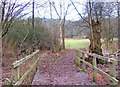
The Robin Trail in Kingsford Forest Park
Kingsford Forest Park is rather overshadowed by the adjoining and better known Kinver Edge. The Park is well worth visiting and has many interesting walks as well as being the home to varied wildlife. From the small car park off Kingsford Lane, the Robin Trail follows a circular walk of about a half km and takes 20 minutes or so. Here in this view it goes over a stream by this wooden footbridge.
Image: © P L Chadwick
Taken: 29 Dec 2008
0.15 miles
2
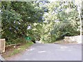
Staffs Border
The view of Kingsford Lane alongside the ridge of Kinver Edge.
Image: © Gordon Griffiths
Taken: 29 Aug 2018
0.15 miles
3
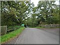
Staffs Border view
The view up Kingsford Lane alongside the ridge of Kinver Edge.
Image: © Gordon Griffiths
Taken: 8 Oct 2020
0.17 miles
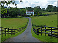
5
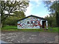
Kingsford Toilets
The view of the closed Public convenience at Kingsford Forest Park car park near Kinver Edge.
Image: © Gordon Griffiths
Taken: 8 Oct 2020
0.18 miles
6
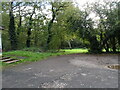
Picnic Site
The view from Kingsford Forest Park car park near Kinver Edge.
Image: © Gordon Griffiths
Taken: 8 Oct 2020
0.18 miles
7
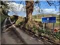
County sign along Sheepwash Lane
On the county boundary of Staffordshire and Worcestershire.
Image: © Mat Fascione
Taken: 10 Feb 2021
0.19 miles
8
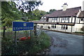
House on the border
The house is on the corner of Sheepwash Lane and Bird's Barn Lane, it lies on the county boundary of Staffordshire and Worcestershire.
Image: © Mat Fascione
Taken: 1 Jul 2020
0.19 miles
10
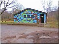
Public convenience at Kingsford Forest Park car park
The small car park on Kingsford Lane is the start of several forest trails. However its main claim to fame must be this extraordinary public convenience with its garish decoration. It surely ought to win some kind of competition for Britain's most hideous looking public convenience. Totally inappropriate for the rural setting, seeing it in reality is even worse than looking at a photo. Every council who has ever ticked someone off for painting their front door the wrong colour should see this and be ashamed.
Image: © P L Chadwick
Taken: 29 Dec 2008
0.19 miles