
IMAGES TAKEN NEAR TO
Firecrest Way, KIDDERMINSTER, DY10 4TF
Introduction
This page details the photographs taken nearby to Firecrest Way, DY10 4TF by members of the Geograph project.
The Geograph project started in 2005 with the aim of publishing, organising and preserving representative images for every square kilometre of Great Britain, Ireland and the Isle of Man.

There are currently over 7.5m images from over14,400 individuals and you can help contribute to the project by visiting https://www.geograph.org.uk
Image Map
Images are licensed for reuse under creativecommons.org/licenses/by-sa/2.0
Notes
- Clicking on the map will re-center to the selected point.
- The higher the marker number, the further away the image location is from the centre of the postcode.
Image Listing (33 Images Found)
Images are licensed for reuse under creativecommons.org/licenses/by-sa/2.0
Image
Details
Distance
1
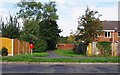
Footpath from Captain's Pool Road to Heronswood Road, Spennells, Kidderminster
The path connects two of the main roads on the estate. This view shows the start of the path, in Captain's Pool Road.
Image: © P L Chadwick
Taken: 29 Sep 2013
0.04 miles
2
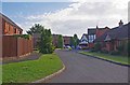
Morillon Court, Spennells, Kidderminster
A small residential cul-de-sac off Imber Road.
Image: © P L Chadwick
Taken: 29 Sep 2013
0.05 miles
3
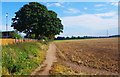
Public bridleway near Spennells, Kidderminster
The bridleway goes straight ahead. To the right is a path used by the public, but not marked as a public footpath on OS maps.
Image
Image: © P L Chadwick
Taken: 29 Sep 2013
0.07 miles
4
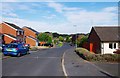
Avocet Drive, Spennells, Kidderminster
A long residential cul-de-sac with more roads off. Photographed from near its junction with Captain's Pool Road.
Image: © P L Chadwick
Taken: 29 Sep 2013
0.07 miles
5
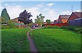
Path to Imber Road, Spennells, Kidderminster
This footpath comes out on the end of Imber Road, where the car is parked.
Image: © P L Chadwick
Taken: 29 Sep 2013
0.07 miles
6
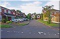
Egret Court, Spennells, Kidderminster
A small residential cul-de-sac off Imber Road.
Image: © P L Chadwick
Taken: 29 Sep 2013
0.07 miles
7
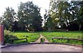
Path from the end of Imber Road, Spennells, Kidderminster
The footpath goes from the end of Imber Road and soon meets three other paths going in various directions. A red dog waste bin can be seen in the distance to the right.
Imber Road was presumably named after the village of Imber on Salisbury Plain in Wiltshire. This was requisitioned by the Army in 1943 for training purposes, the residents were evicted and promised they could return after the end of World War II, but this never happened. The village and surrounding area continue to be used by the Army, with the exception of the Anglican church and grounds.
Image: © P L Chadwick
Taken: 29 Sep 2013
0.08 miles
8
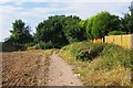
Public bridleway near Spennells, Kidderminster
The bridleway goes ahead into the wooded area and gives access to the Spennells housing estate. To the left a path goes off, running by the field's edge. It is not marked as a public footpath on the OS map but it is certainly much used by the public.
Image
Image: © P L Chadwick
Taken: 29 Sep 2013
0.08 miles
9
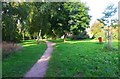
Path through the trees, Spennells, Kidderminster
The footpath has turned off the nearby public bridleway and gives access to the Spennells housing estate. The red bin on the right is for the disposal of dog waste.
Image: © P L Chadwick
Taken: 29 Sep 2013
0.09 miles
10
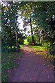
Path leading to public bridleway and field, Spennells, Kidderminster
This path leads to a public bridleway and field. The red bin in the distance is for the disposal of dog waste.
Image: © P L Chadwick
Taken: 29 Sep 2013
0.09 miles