IMAGES TAKEN NEAR TO
Hillpool, KIDDERMINSTER, DY10 4PF
Introduction
This page details the photographs taken nearby to Hillpool, DY10 4PF by members of the Geograph project.
The Geograph project started in 2005 with the aim of publishing, organising and preserving representative images for every square kilometre of Great Britain, Ireland and the Isle of Man.

There are currently over 7.5m images from over14,400 individuals and you can help contribute to the project by visiting https://www.geograph.org.uk
Image Map (Loading...)


Getting Data...Please wait
Leaflet Map data © OpenStreetMap
Images are licensed for reuse under creativecommons.org/licenses/by-sa/2.0
Notes
- Clicking on the map will re-center to the selected point.
- The higher the marker number, the further away the image location is from the centre of the postcode.
Image Listing (6 Images Found)
Images are licensed for reuse under creativecommons.org/licenses/by-sa/2.0
Image
Details
Distance
2
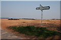
Egg Lane
Egg Lane to the village of Drayton.
Image: © Philip Halling
Taken: 27 May 2016
0.16 miles
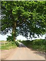
4
Farmland near Hillpool
The large house in the distance is Sion House.
Image: © Philip Halling
Taken: 31 Mar 2007
0.17 miles
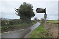
5
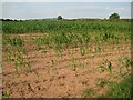
A maize crop near Drayton
A fairly thin maize crop beside Egg Lane near Drayton. The Clent Hills are in the background. Surprised to find no other Geographer has visited this location since my last visit in March 2007, more than seven years ago.
Image: © Philip Halling
Taken: 22 Jul 2014
0.18 miles
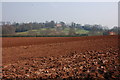
6
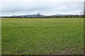
Farmland near Drayton
View over farmland to the Clent Hills from Egg Lane near Drayton.
Image: © Philip Halling
Taken: 4 Mar 2022
0.21 miles