IMAGES TAKEN NEAR TO
Lea Castle Drive, DY10 3FP
Introduction
This page details the photographs taken nearby to Lea Castle Drive, DY10 3FP by members of the Geograph project.
The Geograph project started in 2005 with the aim of publishing, organising and preserving representative images for every square kilometre of Great Britain, Ireland and the Isle of Man.

There are currently over 7.5m images from over14,400 individuals and you can help contribute to the project by visiting https://www.geograph.org.uk
Image Map (6 Images)


Getting Data...Please wait
Leaflet Map data © OpenStreetMap
Images are licensed for reuse under creativecommons.org/licenses/by-sa/2.0
Notes
- Clicking on the map will re-center to the selected point.
- The higher the marker number, the further away the image location is from the centre of the postcode.
Image Listing (6 Images Found)
Images are licensed for reuse under creativecommons.org/licenses/by-sa/2.0
Image
Details
Distance

4
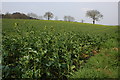
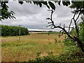
Field of Oil Seed Rape near Cookley
The last day of March and the Oil Seed Rape crop is starting to blossom.
Image: © Philip Halling
Taken: 31 Mar 2007
0.18 miles
5
Footpath through the Lea Castle Village housing development
The development is being built on the site of the former Lea Castle Hospital, the NHS closed the hospital in 2008. The village will have 1,400 homes, as well as a school and community facilities.
Image: © Mat Fascione
Taken: 23 Jul 2022
0.21 miles
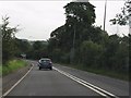
6
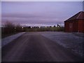
Elan pipeline syphon building
The Elan pipeline cuts through the middle of Cookley - the route is easy to follow because it has not been built on. This is facing east, back towards Iverley.
Image: © Simon Jobson
Taken: 22 Nov 2008
0.23 miles