IMAGES TAKEN NEAR TO
Upton Road, KIDDERMINSTER, DY10 2YB
Introduction
This page details the photographs taken nearby to Upton Road, DY10 2YB by members of the Geograph project.
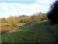
The Geograph project started in 2005 with the aim of publishing, organising and preserving representative images for every square kilometre of Great Britain, Ireland and the Isle of Man.

There are currently over 7.5m images from over14,400 individuals and you can help contribute to the project by visiting https://www.geograph.org.uk
Image Map
Images are licensed for reuse under creativecommons.org/licenses/by-sa/2.0
Notes
- Clicking on the map will re-center to the selected point.
- The higher the marker number, the further away the image location is from the centre of the postcode.
Image Listing (102 Images Found)
Images are licensed for reuse under creativecommons.org/licenses/by-sa/2.0
Image
Details
Distance
2
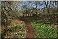
Path on the edge of Springfield Park
This is one of the many paths in and near to Springfield Park, which is owned and managed by Wyre Forest District Council.
Image: © P L Chadwick
Taken: 13 Jun 2009
0.08 miles
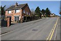
3
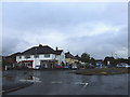
Sion Hill, Kidderminster, Worcs
A 10% grade hill
Image: © Richard Rogerson
Taken: 20 Feb 2010
0.12 miles
4
Footpath to the Sports Ground, Springfield Park, Kidderminster, Worcs
This footpath branches off a footpath crossing an adjacent field and leads to the Sports Ground in Springfield Park.
Image
Image: © P L Chadwick
Taken: 15 Jan 2023
0.13 miles
5
Footpath from Sports Ground, Springfield Park, Kidderminster, Worcs
This footpath leads out of the Sports Ground and connects with paths in an adjacent field.
Image
Image: © P L Chadwick
Taken: 15 Jan 2023
0.14 miles
6
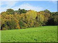
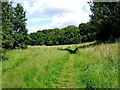
Trees at edge of field, Springfield Park, Kidderminster
It's never been quite clear whether this field is actually in the park or not, but to all intents and purposes it seems to be, as there is a public footpath across it and people, with or without their dogs, wander all over it.
Image: © P L Chadwick
Taken: 13 Nov 2013
0.14 miles
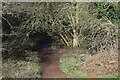
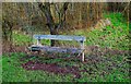
7
Path and marker post, Springfield Park
The marker post is one of several, which have been put up in the park in the last year or so.
Image: © P L Chadwick
Taken: 17 Jan 2011
0.14 miles
8
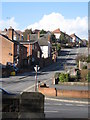
Sion Hill
Sion Hill, a road off Stourbridge Road, leading to Wolverley.
Image: © Philip Halling
Taken: 5 Apr 2018
0.15 miles
9
Tree nursery area, Springfield Park
The fenced off area is where an attempt is being made to grow young trees.
A closer view:- Image
Image: © P L Chadwick
Taken: 17 Jan 2011
0.15 miles
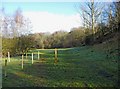
10
Seat in Sports Ground, Springfield Park, Kidderminster, Worcs
There are now seats on every side of the area known as the Sports Ground, of which this is one.
Image: © P L Chadwick
Taken: 31 Dec 2021
0.15 miles