IMAGES TAKEN NEAR TO
Kendlewood Road, KIDDERMINSTER, DY10 2XH
Introduction
This page details the photographs taken nearby to Kendlewood Road, DY10 2XH by members of the Geograph project.
The Geograph project started in 2005 with the aim of publishing, organising and preserving representative images for every square kilometre of Great Britain, Ireland and the Isle of Man.

There are currently over 7.5m images from over14,400 individuals and you can help contribute to the project by visiting https://www.geograph.org.uk
Image Map (Loading...)


Getting Data...Please wait
Leaflet Map data © OpenStreetMap
Images are licensed for reuse under creativecommons.org/licenses/by-sa/2.0
Notes
- Clicking on the map will re-center to the selected point.
- The higher the marker number, the further away the image location is from the centre of the postcode.
Image Listing (13 Images Found)
Images are licensed for reuse under creativecommons.org/licenses/by-sa/2.0
Image
Details
Distance
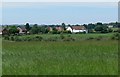
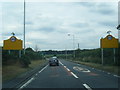
1
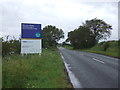
A451 towards Kidderminster
Looking south west beside a new housing development.
Image: © JThomas
Taken: 8 Jun 2019
0.13 miles
2
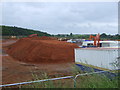
New housing development on the outskirts of Kidderminster
Image: © JThomas
Taken: 8 Jun 2019
0.14 miles
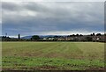
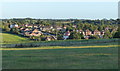
3
View towards Broadwaters
Broadwaters is an area on the northeastern edge of Kidderminster. Viewed looking west from Hurcott Lane.
Image: © Mat Fascione
Taken: 8 Jun 2008
0.14 miles
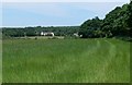
4
Farmland next to Hurcott Lane
The houses are part of a new develepmont called Weavers Chase, on the eastern edge of Kidderminster.
Image: © Mat Fascione
Taken: 28 Mar 2020
0.16 miles
5
Broadwaters on the edge of Kidderminster
Image: © Mat Fascione
Taken: 6 Oct 2023
0.18 miles
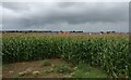
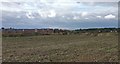
6
Countryside near Hurcott Wood
The buildings in the distance are along the A451 Stourbridge Road at the junction with Park Gate Road.
Image: © Mat Fascione
Taken: 8 Jun 2008
0.20 miles
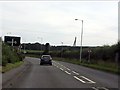
7
A449 leaving Kidderminster at Broadwaters
Image: © Colin Pyle
Taken: 7 Aug 2015
0.20 miles
8
Broadwaters in Kidderminster
A suburb on the northern edge of Kidderminster.
Image: © Mat Fascione
Taken: 9 Sep 2020
0.20 miles