
IMAGES TAKEN NEAR TO
Stourbridge Road, KIDDERMINSTER, DY10 2UH
Introduction
This page details the photographs taken nearby to Stourbridge Road, DY10 2UH by members of the Geograph project.
The Geograph project started in 2005 with the aim of publishing, organising and preserving representative images for every square kilometre of Great Britain, Ireland and the Isle of Man.

There are currently over 7.5m images from over14,400 individuals and you can help contribute to the project by visiting https://www.geograph.org.uk
Image Map
Images are licensed for reuse under creativecommons.org/licenses/by-sa/2.0
Notes
- Clicking on the map will re-center to the selected point.
- The higher the marker number, the further away the image location is from the centre of the postcode.
Image Listing (108 Images Found)
Images are licensed for reuse under creativecommons.org/licenses/by-sa/2.0
Image
Details
Distance
1
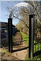
Arched entrance to Springfield Park
Entrance to Springfield Park and footpath which follows the back of a stream, a tributary of the River Stour.
Image: © Philip Halling
Taken: 5 Apr 2018
0.01 miles
2
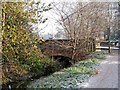
Broadwaters Bridge
The footpath from Springfield Park ends here at Broadwaters Bridge (seen on the left), which carries the A449 road across the stream, which runs alongside the path. The bridge was built in 1937 by Worcestershire County Council. Image
Image: © P L Chadwick
Taken: 23 Dec 2009
0.02 miles
3
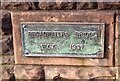
Broadwaters Bridge plaque
Built in 1937, by Worcestershire County Council, to carry the A449 road across a small stream. Image
Image: © P L Chadwick
Taken: 23 Dec 2009
0.02 miles
4
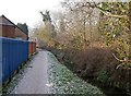
Path to Springfield Park from Chester Road
The path leads to the public park known as Springfield Park. Image
Image: © P L Chadwick
Taken: 23 Dec 2009
0.02 miles
5
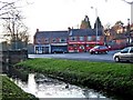
Shops in The Parade, Stourbridge Road, Broadwaters
The Parade is a terrace of four shop units serving the Broadwaters area of Kidderminster. In December 2008 the units were taken by Broadwaters Chippy, Broadwaters Community Cafe plus two units were used by Broadwaters Wine Cellar & Convenience Store. Quite a useful selection.
Image: © P L Chadwick
Taken: 7 Dec 2008
0.03 miles
6
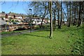
Broadwaters Park
Broadwaters Park beside Stourbridge Road, the bridge on the left carrying the road over a stream which is a tributary of the River Stour.
Image: © Philip Halling
Taken: 5 Apr 2018
0.04 miles
7
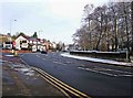
Broadwaters Bridge
The bridge was built in 1937, by Worcestershire County Council, to carry the A449 road across a small stream. Image; Image
Image: © P L Chadwick
Taken: 23 Dec 2009
0.05 miles
8
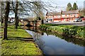
Stream flowing through Broadwaters
A stream flowing through Broadwaters with shops over the road on the junction with Sion Hill.
Image: © Philip Halling
Taken: 5 Apr 2018
0.05 miles
9
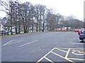
Broadwaters Park car park
Image: © P L Chadwick
Taken: 1 Jan 2009
0.07 miles
10
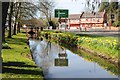
Stream beside Stourbridge Road
Stream beside Stourbridge Road approaching the junction with Sion Hill. The shops over the road are on the junction with Sion Hill.
Image: © Philip Halling
Taken: 5 Apr 2018
0.07 miles