IMAGES TAKEN NEAR TO
Pat Davis Court, KIDDERMINSTER, DY10 2NF
Introduction
This page details the photographs taken nearby to Pat Davis Court, DY10 2NF by members of the Geograph project.
The Geograph project started in 2005 with the aim of publishing, organising and preserving representative images for every square kilometre of Great Britain, Ireland and the Isle of Man.

There are currently over 7.5m images from over14,400 individuals and you can help contribute to the project by visiting https://www.geograph.org.uk
Image Map
Images are licensed for reuse under creativecommons.org/licenses/by-sa/2.0
Notes
- Clicking on the map will re-center to the selected point.
- The higher the marker number, the further away the image location is from the centre of the postcode.
Image Listing (190 Images Found)
Images are licensed for reuse under creativecommons.org/licenses/by-sa/2.0
Image
Details
Distance
4
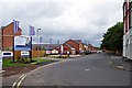
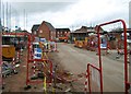
Bellway's Keepers Lock housing development, Clensmore Street, Kidderminster
A new housing development called Keepers Lock being developed by Bellway, of Newcastle upon Tyne, on former carpet factory land. The signs include one saying there is an armed forces discount. In the middle of this view is the Bellway Sales Centre. On the near right is part of the premises of Veldonn Printers Ltd, formerly the Navigation public house.
Image: © P L Chadwick
Taken: 1 Jul 2012
0.13 miles
5
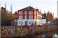
Veldonn Printers Ltd., 46 Clensmore Street, Kidderminster
A local printing firm. In the foreground is the Staffs & Worcs Canal. The main building used to be a public house called the Navigation. It was a Banks's Brewery house. In times past it no doubt received a lot of trade from canal users and from the two nearby carpet factories (both now closed). The later buildings, at the side, were built after the change of use.
Image
Image: © P L Chadwick
Taken: 15 Jan 2012
0.15 miles
6
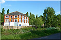
Canal and printing works in Kiddermiminster, Worcestershire
Veldonn Printers Ltd is seen across the Staffordshire and Worcestershire Canal. Limekiln Bridge (No 17) is off to the right.
Image: © Roger Kidd
Taken: 14 May 2014
0.15 miles
7

Veldonn Printers
From the Staffordshire and Worcestershire Canal.
Image: © Andrew Abbott
Taken: 22 May 2025
0.15 miles
8
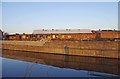
Old industrial buildings near the Staffs & Worcs Canal, Kidderminster
These buildings were demolished between January and July 2012. They may have been offices. Behind and to the southeast of them were single storey buildings, most or which were probably carpet weaving sheds.
See also:- Image
Image: © P L Chadwick
Taken: 15 Jan 2012
0.15 miles
9
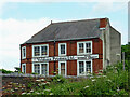
Printers in Clensmore Street, Kidderminster
Seen from the canal south of Limekilns Bridge.
Image]
Image: © Roger Kidd
Taken: 24 Jun 2013
0.15 miles