1
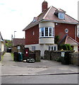
King George V postbox in a Horsecastles wall, Sherborne
Located here. http://www.geograph.org.uk/photo/4478110
Image: © Jaggery
Taken: 13 May 2015
0.01 miles
2
Postbox in a Horsecastles wall, Sherborne
Viewed Horsecastles. The postbox http://www.geograph.org.uk/photo/4478085 is from the reign of King George V (May 1910-January 1936).
Image: © Jaggery
Taken: 13 May 2015
0.01 miles
3
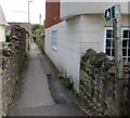
Public footpath from Horsecastles, Sherborne
The path between houses heads SSE away from the street named Horsecastles.
Image: © Jaggery
Taken: 13 May 2015
0.02 miles
4
Former Sherborne Abbey VC Primary School, Sherborne
Viewed across Old School Lane near the corner of Horsecastles in May 2015. The former school has been converted to residential use. The school is now located at the extreme western edge of Sherborne at the end of Lenthay Road. The school relocated in 2000, for various reasons, including increasing pupil numbers, inadequate facilities here, and child & traffic safety. VC in the school name indicates a Voluntary Controlled school, which must provide for all pupils to take part in a daily act of collective worship, which must reflect the broad traditions of Christian belief and be wholly Christian in character.
Image: © Jaggery
Taken: 13 May 2015
0.02 miles
5
School Lane
An old and rather narrow lane that runs past the Abbey School. Modern housing now forms most of the view, but a benchmark can still be seen on the doorway to the left - see
Image
Image: © Neil Owen
Taken: 15 May 2014
0.02 miles
6
An old way to school
This innocent looking doorway is part of the Abbey School, although it seems they use a different one now. The benchmark on the right is listed in the Benchmark Database: http://www.bench-marks.org.uk/bm45158 . Also see
Image] for a wider view.
Image: © Neil Owen
Taken: 15 May 2014
0.02 miles
7
Benchmark on Abbey School, Sherborne
Ordnance Survey benchmark, described on database at http://www.bench-marks.org.uk/bm45158.
Image: © Becky Williamson
Taken: 28 Jul 2015
0.02 miles
8
No Hawkers
Especially hawkers on bikes.
Image: © Neil Owen
Taken: 15 May 2014
0.02 miles
9
Horsecastles houses and cars, Sherborne
Viewed across the street named Horsecastles from the corner of Old School Place.
Image: © Jaggery
Taken: 13 May 2015
0.03 miles
10
Old school lane
Now crowded by modern housing, this is School Lane, a public footpath; it runs alongside Abbey School.
Image: © Neil Owen
Taken: 15 May 2014
0.03 miles


