1
A35 at Miles Cross
At the junction of the new and the old A35s - the latter now the B3162. The gap in the trees on the right side of the main road 150 metres away is where the line of the old road meets the new road, and its course before the B road was re-aligned to provide a safer junction. The stretch of dual carriageway is limited to about 170 metres on either side of the modern junction and doesn't allow for overtaking, to the chagrin of motorists in a hurry.
Image: © Derek Harper
Taken: 31 Oct 2015
0.11 miles
2
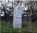
Milestone at Miles Cross on the A35
A nice old milestone tucked away in the undergrowth on a bank beside the A35 at Miles Cross. I've driven past it hundreds of times without noticing it, but it seems to be fairly well cared for.
Image: © Stephen Williams
Taken: 13 Mar 2007
0.15 miles
3
Old Milestone by the A35, Miles Cross
Carved stone post by the A35, in parish of SYMONDSBURY (WEST DORSET District), Bridport, junction of B3162 with bypass, on South side of road, on bank by farm track to fields. Re-located during junction re-alignment. Dorset 1 (limestone), erected by the Bridport - First District turnpike trust in the 19th century.
Inscription reads:-
1
to
BRIDPORT
11
to
AXMINSTER
Milestone Society National ID: DO_AXBP11
Image: © Mike Faherty
Taken: 17 Aug 2008
0.16 miles
4
A35, end of the Bridport bypass
Image: © N Chadwick
Taken: 2 Jun 2012
0.16 miles
5
Cottages at Miles Cross, near Bridport
This is the end of West Road where it joins up with the A35. Before the by-pass was built, this was the A35, and part of the old course of the road can be seen just beyond the oncoming car.
The junction at Miles Cross is a notorious accident black-spot, and there is a campaign to replace the T-junction with a roundabout.
Image: © Stephen Williams
Taken: 13 Mar 2007
0.19 miles
6
Waterlogged fields, Vearse Farm
View towards Bridport. This waterlogged land is south of the B3162 West Allington and will be part of the Vearse Farm development of 760 dwellings, employment units, shops, a pub, school and old people's home. The plan is currently in the detailed design stages, and was agreed in principle by the West Dorset District Council despite vehement opposition from the local town and parish councils and population. One of the many objections raised was that of flooding and water run off.
Image: © John Stephen
Taken: 15 Mar 2018
0.20 miles
7
Reception committee
A bunch of curious sheep guarding the public footpath across a field near Miles Cross. The path is unmarked across the field, and the way through to the next field (when you find it) involves stepping over an electric fence over a puddle and crossing a ditch by way of a slippery 9" wide plank.
It does get better further up the path. If you are using this picture to help plan a walk, the path goes up the hill to the left of the hedge in the top left corner. Very steep in places, but the view over Bridport makes it worthwhile.
Image: © Stephen Williams
Taken: 13 Mar 2007
0.21 miles
8
Ilchester Arms, Symondsbury
Image: © John H Darch
Taken: 26 Oct 2015
0.21 miles
9
Civilization, near the A35
Looking over Bridport from Eype Down
Image: © Ralph Mills
Taken: 16 Feb 2006
0.22 miles
10
Waterlogged fields, Vearse Farm
This waterlogged land is south of the B3162 West Allington and will be part of the Vearse Farm development of 760 dwellings, employment units, shops, a pub, school and old people's home. The plan is currently in the detailed design stages, and was agreed in principle by the West Dorset District Council despite vehement opposition from the local town and parish councils and population. One of the many objections raised was that of flooding and water run off.
Image: © John Stephen
Taken: 15 Mar 2018
0.22 miles


