IMAGES TAKEN NEAR TO
Dottery, BRIDPORT, DT6 5HR

Introduction

This page details the photographs taken nearby to DT6 5HR by members of the Geograph project.

The Geograph project started in 2005 with the aim of publishing, organising and preserving representative images for every square kilometre of Great Britain, Ireland and the Isle of Man.

There are currently over 7.5m images from over14,400 individuals and you can help contribute to the project by visiting https://www.geograph.org.uk

Image Map


Images are licensed for reuse under creativecommons.org/licenses/by-sa/2.0
Notes
  • Clicking on the map will re-center to the selected point.
  • The higher the marker number, the further away the image location is from the centre of the postcode.

Image Listing (12 Images Found)

Images are licensed for reuse under creativecommons.org/licenses/by-sa/2.0
Image
Details
Distance
1
Waddon Barn
This entrance road is also used for Westway Business Park, up to the left.
Image: © Derek Harper Taken: 13 Mar 2017
0.03 miles
2
Waddon Barn
Waddon Barn was originally a farm and there is still a farm on the site but there is also a large depot of a scaffolding company (which can be seen in the distance) and some horse paddocks such as those on the left.
Image: © Nigel Mykura Taken: 18 Jun 2011
0.05 miles
3
Entrance to New Close Farm, Dottery Road
The white-rendered building is New Close Cottage.
Image: © Roger Templeman Taken: 20 Feb 2011
0.10 miles
4
Field by Waddon Barn
From the same spot as Image], looking left across the field. The barn that can be made out in the centre is a further field away on Bilshay Lane.
Image: © Derek Harper Taken: 13 Mar 2017
0.10 miles
5
B3162 near Dottery
From the entrance driveway to Westway Business Park. The building in the centre is the Old Gardeners’ Arms, which ceased to function as a pub many years ago. On the horizon is much of the hamlet of Dottery.
Image: © Derek Harper Taken: 13 Mar 2017
0.11 miles
6
Old Gardeners Arms
Image: © Roger Cornfoot Taken: 12 Aug 2024
0.11 miles
7
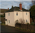
Dog-Kennel Gate Tollhouse, Dottery Road, Allington
Toll House by the B3162, in the parish of Allington (West Dorset District), The Old Tollhouse, Dottery Road, DT6. Surveyed Milestone Society National ID: DO.ALL
Image: © Alan Rosevear Taken: 6 Jan 2008
0.12 miles
8
Barn conversion near Waddon Barn
Image: © Becky Williamson Taken: 23 Nov 2017
0.14 miles
9
Benchmark on 'Watercleaves', Dottery Road
Ordnance Survey cut mark benchmark described on the Bench Mark Database at http://www.bench-marks.org.uk/bm37076
Image: © Roger Templeman Taken: 20 Feb 2011
0.17 miles
10
B3162 Dottery Road
By Washingpool Farm shop
Image: © Chris Gunns Taken: 1 Jun 2019
0.19 miles