
IMAGES TAKEN NEAR TO
Glebe Close, WEYMOUTH, DT4 9RL
Introduction
This page details the photographs taken nearby to Glebe Close, DT4 9RL by members of the Geograph project.
The Geograph project started in 2005 with the aim of publishing, organising and preserving representative images for every square kilometre of Great Britain, Ireland and the Isle of Man.

There are currently over 7.5m images from over14,400 individuals and you can help contribute to the project by visiting https://www.geograph.org.uk
Image Map
Images are licensed for reuse under creativecommons.org/licenses/by-sa/2.0
Notes
- Clicking on the map will re-center to the selected point.
- The higher the marker number, the further away the image location is from the centre of the postcode.
Image Listing (87 Images Found)
Images are licensed for reuse under creativecommons.org/licenses/by-sa/2.0
Image
Details
Distance
1
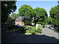
Lansdowne Square
Which is actually triangular.
Image: © Neil Owen
Taken: 26 May 2023
0.10 miles
2
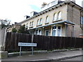
Buxton Rd Weymouth.
These Victorian houses are on the corner of Connaught Rd and Buxton Rd
Image: © Nigel Mykura
Taken: 24 Mar 2008
0.11 miles
6
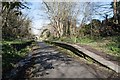
Rodwell Station
Now disused and part of the Rodwell Trail.
Image: © Becky Williamson
Taken: 8 Mar 2018
0.12 miles
8
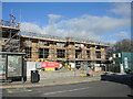
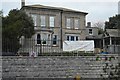
New build on the old car park
A small car park space has been given over to a new construction.
Image: © Neil Owen
Taken: 18 Nov 2022
0.12 miles
10
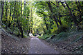
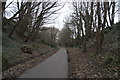
A forested cutting on the Rodwell Trail
On the route of the old Weymouth to Portland railway.
Image: © John Lucas
Taken: 14 Oct 2020
0.13 miles