
IMAGES TAKEN NEAR TO
Roundham Gardens, WEYMOUTH, DT4 0RL
Introduction
This page details the photographs taken nearby to Roundham Gardens, DT4 0RL by members of the Geograph project.
The Geograph project started in 2005 with the aim of publishing, organising and preserving representative images for every square kilometre of Great Britain, Ireland and the Isle of Man.

There are currently over 7.5m images from over14,400 individuals and you can help contribute to the project by visiting https://www.geograph.org.uk
Image Map
Images are licensed for reuse under creativecommons.org/licenses/by-sa/2.0
Notes
- Clicking on the map will re-center to the selected point.
- The higher the marker number, the further away the image location is from the centre of the postcode.
Image Listing (20 Images Found)
Images are licensed for reuse under creativecommons.org/licenses/by-sa/2.0
Image
Details
Distance
1
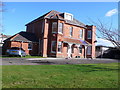
The Oaks, Chickerell Rd Weymouth
This old house is now part of a day centre
Image: © Nigel Mykura
Taken: 30 Jan 2008
0.07 miles
2
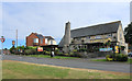
The Admiral Hardy
A suburban pub on Chickerell Road named after Sir Thomas Masterman Hardy of Battle of Trafalgar fame, who was a Dorset man. He went on to become First Sea Lord in 1830.
He was a distant relation of Dorset's other famous Thomas Hardy, the author.
Image: © Des Blenkinsopp
Taken: 31 May 2019
0.09 miles
3
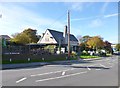
Lanehouse, The Admiral Hardy
Suburban pub on Chickerell Road. Internally, L-shaped back bar with eating and drinking areas front and right; pool, darts, TV, games machines, conservatory, terrace. Cask ales on offer at my visit: Ringwood Best, Forty Niner. For some customer comments, see http://www.beerintheevening.com/pubs/s/32/32448/Admiral_Hardy/Weymouth
Image: © Mike Faherty
Taken: 23 Oct 2013
0.09 miles
5
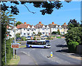
Bus on Chickerell Road
Leaving Abbotsbury Road.
Image: © Des Blenkinsopp
Taken: 31 May 2019
0.12 miles
7
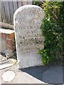
Weymouth: boundary stone on Chickerell Road
This stone stands near the corner of Markham Avenue and is inscribed: BOROUGH OF WEYMOUTH AND MELCOMBE REGIS. T.H. WILLIAMS, MAYOR
It is undated, but T.H. Williams was mayor of the borough in 1896, so it presumably dates from around then (UPDATE: I have located another similar stone which shows that the date on this one has eroded away: Image]).
The borough has extended outwards since then, as is evident from the boundary symbol on modern-day maps.
Image: © Chris Downer
Taken: 29 May 2016
0.14 miles
8
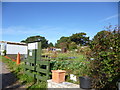
Westham, allotments
Off Abbotsbury Road.
Image: © Mike Faherty
Taken: 23 Oct 2013
0.15 miles
10
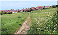
Footpath to Markham Avenue
Surrounded by housing is a large area of old fields that has avoided being built over. It doesn't appear to be a park as such, just grassland and trees.
Image: © Des Blenkinsopp
Taken: 31 May 2019
0.19 miles