IMAGES TAKEN NEAR TO
Sedgefield Close, WEYMOUTH, DT4 0LD
Introduction
This page details the photographs taken nearby to Sedgefield Close, DT4 0LD by members of the Geograph project.
The Geograph project started in 2005 with the aim of publishing, organising and preserving representative images for every square kilometre of Great Britain, Ireland and the Isle of Man.

There are currently over 7.5m images from over14,400 individuals and you can help contribute to the project by visiting https://www.geograph.org.uk
Image Map
Images are licensed for reuse under creativecommons.org/licenses/by-sa/2.0
Notes
- Clicking on the map will re-center to the selected point.
- The higher the marker number, the further away the image location is from the centre of the postcode.
Image Listing (100 Images Found)
Images are licensed for reuse under creativecommons.org/licenses/by-sa/2.0
Image
Details
Distance
1
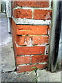
Benchmark on #28 Knightsdale Road
Ordnance Survey cut mark benchmark described on the Bench Mark Database at http://www.bench-marks.org.uk/bm36360
Image: © Roger Templeman
Taken: 23 Dec 2010
0.05 miles
2
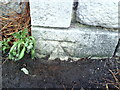
Benchmark on wall pier of cemetery, Newstead Road
Ordnance Survey cut mark benchmark described on the Bench Mark Database at http://www.bench-marks.org.uk/bm36359
Image: © Roger Templeman
Taken: 23 Dec 2010
0.05 miles
3
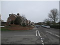
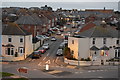
Knightsdale Road
Looking down Knightsdale Road towards the town. The Marsh Sports Ground is on the right.
Image: © John Stephen
Taken: 10 Mar 2017
0.06 miles
5
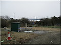
Pumping station, Knightsdale Road
Underground pumping station on Knightsdale Road next to the Marsh Sports Ground, presumably to keep the marsh drained. The bridge taking the Rodwell Trail over Newstead Road can be seen in the background.
Image: © John Stephen
Taken: 10 Mar 2017
0.09 miles
6
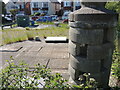
Vented in Knightsdale Road
A partly vented pillar near the sports ground stands by some large manholes. Another such pillar stands in The Marsh, some half a mile away.
Image: © Neil Owen
Taken: 26 May 2023
0.09 miles
7
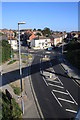
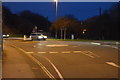
Newstead Road
View north from the Rodwell Trail footbridge over Newstead Road.Newstead road carries on forking right at the mini-roundabout to Abbotsbury Road. Image Image
Image: © John Stephen
Taken: 5 Sep 2012
0.09 miles
9
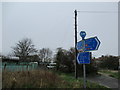
Footpath junction Newstead Road
Looking towards the Outdoor Education Centre and Marsh Sports Ground
Image: © John Stephen
Taken: 10 Mar 2017
0.09 miles