IMAGES TAKEN NEAR TO
Beverley Road, WEYMOUTH, DT3 6QU
Introduction
This page details the photographs taken nearby to Beverley Road, DT3 6QU by members of the Geograph project.
The Geograph project started in 2005 with the aim of publishing, organising and preserving representative images for every square kilometre of Great Britain, Ireland and the Isle of Man.

There are currently over 7.5m images from over14,400 individuals and you can help contribute to the project by visiting https://www.geograph.org.uk
Image Map
Images are licensed for reuse under creativecommons.org/licenses/by-sa/2.0
Notes
- Clicking on the map will re-center to the selected point.
- The higher the marker number, the further away the image location is from the centre of the postcode.
Image Listing (41 Images Found)
Images are licensed for reuse under creativecommons.org/licenses/by-sa/2.0
Image
Details
Distance
1
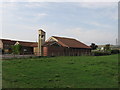
St. Francis Church Littlemoor
St. Francis Church, modern church built near Community centre on Littlemoor Housing Estate, Weymouth
Image: © Carl Whitehouse
Taken: 6 Sep 2006
0.11 miles
2
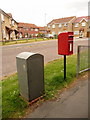
Littlemoor: postbox № DT3 85, Turnstone Close
This small postbox is emptied finally at 4pm on weekdays and at 8am on Saturdays. Alongside is a drop box (see below).
Pipit Close is the turning in the distance, named after a species of bird as with all the turnings along here.
Image: © Chris Downer
Taken: 30 May 2010
0.12 miles
3
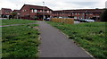
Path towards Turnstone Close and Kestrel View, Weymouth
Accessed from these https://www.geograph.org.uk/photo/5959215 steps down from Littlemoor Road.
Image: © Jaggery
Taken: 8 Sep 2018
0.15 miles
4
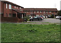
Kestrel View, Weymouth
Houses at the northern end of Kestrel View near Turnstone Close in the north of Weymouth.
Image: © Jaggery
Taken: 8 Sep 2018
0.16 miles
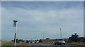
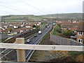
6
Weymouth Relief Road (16)
When the Littlemoor housing estates were built this gap was left to accommodate any relief road. This is looking SW from the Littlemoor road towards Weymouth along the line the new road will take.
Image: © Nigel Mykura
Taken: 28 Dec 2008
0.17 miles
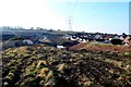
7
Power lines over housing estate at Upwey
Image: © David Smith
Taken: 28 Sep 2020
0.17 miles
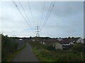
8
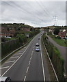
Weymouth Relief Road
In 2011 the route of the A354 in Weymouth was changed to use this newly-built road
which bypasses bottlenecks on the former route of the A354 in Upwey and Broadwey.
Image: © Jaggery
Taken: 8 Sep 2018
0.17 miles
10
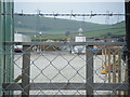
Protected Pineapple
One of the two "Welcome to Weymouth and Portland" stone pineapples, temporarily displaced by the construction of the new relief road, in safe keeping.
Image: © Ivan Hall
Taken: 19 Sep 2009
0.18 miles