1
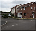
Goldcrest Close, Weymouth
Cul-de-sac extending from the road named The Finches to vegetation and a wall below the A354 Weymouth Relief Road.
Image: © Jaggery
Taken: 8 Sep 2018
0.02 miles
2
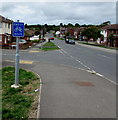
Junction of Goldcrest Close and The Finches, Weymouth
Goldcrest Close http://www.geograph.org.uk/photo/5899113 from the left joins The Finches.
Image: © Jaggery
Taken: 8 Sep 2018
0.02 miles
3
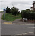
South along The Finches, Weymouth
The cars are parked in the road named The Finches, behind the right turn into Linnet Close. http://www.geograph.org.uk/photo/5899092
Image: © Jaggery
Taken: 8 Sep 2018
0.02 miles
4
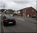
Littlemoor Road Bridge and Weymouth Relief Road
Rapidly taking shape. The roundabout on the OS maps is no more.
Image: © Ivan Hall
Taken: 19 Sep 2009
0.03 miles
5
End of cycle route, Littlemoor Road, Weymouth
The sign is on the corner of the road named The Finches.
Image: © Jaggery
Taken: 8 Sep 2018
0.04 miles
6
The Finches, Weymouth
The name sign is at the northern end of the road named The Finches, near the corner of Littlemoor Road.
The Finches leads to cul-de-sacs with bird-themed names such as Sanderling Close and Linnet Close.
Image: © Jaggery
Taken: 8 Sep 2018
0.04 miles
7
Cycle route 5 signpost, Littlemoor Road, Weymouth
The signpost is alongside National Cycle Network Route 5.
Left for Preston (Dorset) 2 miles away, right for Upwey railway
station (half a mile) and Weymouth town centre (3 miles).
Image: © Jaggery
Taken: 8 Sep 2018
0.04 miles
8
Junction of Sanderling Close and The Finches, Weymouth
Sanderling Close from the right joins The Finches.
Image: © Jaggery
Taken: 8 Sep 2018
0.04 miles
9
Linnet Close, Weymouth
Cul-de-sac on the west side of the road named The Finches.
Image: © Jaggery
Taken: 8 Sep 2018
0.04 miles
10
Upwey
Power lines above Weymouth Relief Road.
Image: © Burgess Von Thunen
Taken: 14 Aug 2012
0.05 miles


