IMAGES TAKEN NEAR TO
St. Lawrence Road, WEYMOUTH, DT3 5NF
Introduction
This page details the photographs taken nearby to St. Lawrence Road, DT3 5NF by members of the Geograph project.
The Geograph project started in 2005 with the aim of publishing, organising and preserving representative images for every square kilometre of Great Britain, Ireland and the Isle of Man.

There are currently over 7.5m images from over14,400 individuals and you can help contribute to the project by visiting https://www.geograph.org.uk
Image Map (Loading...)


Getting Data...Please wait
Leaflet Map data © OpenStreetMap
Images are licensed for reuse under creativecommons.org/licenses/by-sa/2.0
Notes
- Clicking on the map will re-center to the selected point.
- The higher the marker number, the further away the image location is from the centre of the postcode.
Image Listing (30 Images Found)
Images are licensed for reuse under creativecommons.org/licenses/by-sa/2.0
Image
Details
Distance
1
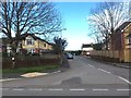
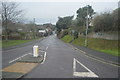
Shortlands Road
Looking up Shortlands Road from Dorchester Road
Image: © W
Taken: 25 Apr 2018
0.04 miles
2
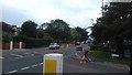
Dorchester Road
Looking along Dorchester Road from Stottingway Street
Image: © W
Taken: 24 Jun 2019
0.07 miles
3
Dorchester Road
Looking along Dorchester Road from Stottingway Street
Image: © W
Taken: 25 Apr 2018
0.08 miles
6
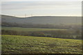
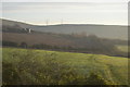
View east from the railway line north of Upwey
Image: © N Chadwick
Taken: 28 Dec 2018
0.10 miles
7
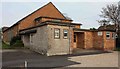
Upwey and Broadwey Memorial Hall
The Memorial Hall in Upwey is still in constant use today. The 'cornerstone' was laid in 1955 by Percy Lovell Esq.
Image: © Geoff Trim
Taken: 23 Apr 2009
0.11 miles
8
"Sir Lamiel" about to cross Chapel Lane, Upwey
Weekly steam hauled excursion trains run from London Victoria to Weymouth during late summer. King Arthur Class 4-6-0 No. 30777 "Sir Lamiel" speeds past Coombe Farm with the 1Z96 service on 4/8/10 now only a few minutes from arrival at Weymouth.
Image: © Tim Marshall
Taken: 4 Aug 2010
0.12 miles
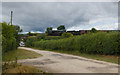
9
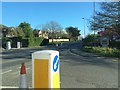
Boundary Marker Post at Old Station Road, Broadwey
Reads: Borough Of weymouth and Melcombe Regis 1933 Hamblin Mayor
Image: © Tim Marshall
Taken: 31 Jul 2010
0.13 miles
10
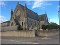
Former Upwey United Reformed Church along Dorchester Road
Originally Upwey Congregational Chapel, built in 1881 as a replacement for an earlier building of 1809 and occupying a commanding position at the corner of Chapel Lane, with an attached schoolroom and adjoining manse (well seen in Nigel Mykura's photograph Image). The architect was R.C. Bennett of Weymouth. In 1958 the building was saved from closure through a link with Radipole Congregational Church. In 1972, with the formation of the United Reformed Church, the chapel became the Upwey URC and the manse was sold. In February 1990 a storm damaged the west front. The last service at the church was held in July 1992.
Image: © W
Taken: 25 Apr 2018
0.14 miles