IMAGES TAKEN NEAR TO
Highfield Close, DORCHESTER, DT2 9RW
Introduction
This page details the photographs taken nearby to Highfield Close, DT2 9RW by members of the Geograph project.
The Geograph project started in 2005 with the aim of publishing, organising and preserving representative images for every square kilometre of Great Britain, Ireland and the Isle of Man.

There are currently over 7.5m images from over14,400 individuals and you can help contribute to the project by visiting https://www.geograph.org.uk
Image Map (Loading...)


Getting Data...Please wait
Leaflet Map data © OpenStreetMap
Images are licensed for reuse under creativecommons.org/licenses/by-sa/2.0
Notes
- Clicking on the map will re-center to the selected point.
- The higher the marker number, the further away the image location is from the centre of the postcode.
Image Listing (13 Images Found)
Images are licensed for reuse under creativecommons.org/licenses/by-sa/2.0
Image
Details
Distance
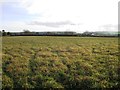
1
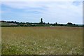
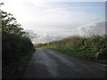
Field Near Charminster
View SE towards the rear of the houses at the northern edge of the village from near the minor road that runs from the Cerne Valley west to the Frome Valley
Image: © Nigel Mykura
Taken: 24 Jul 2008
0.04 miles
2
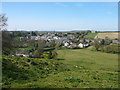
View across Cerne Valley to the northern edge of Charminster
Image: © Colin Park
Taken: 7 Apr 2011
0.07 miles
3
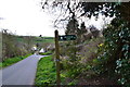
Footpath sign, to Wanchard Lane, Charminster
Image: © Peter Barr
Taken: 27 Apr 2013
0.07 miles
4
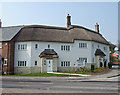
Pink Moon Cottages - Charminster
A group of cottages, part of a new development just off the A352, 3 miles north of Dorchester.
Image: © Mike Searle
Taken: 15 Apr 2007
0.08 miles
5
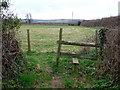
Redundant Stile
The stile was still there at this opening but the fence had gone. So why climb when you can just walk past? The farmer has run a second fence along the footpath making a narrow walkway for the footpath between hedge and new fence.
Image: © Nigel Mykura
Taken: 17 Mar 2012
0.08 miles
6
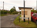
Charminster: postbox № DT2 29, North Street
This postbox serves northern Charminster and is emptied finally at 10:30 on weekday mornings and, unusually, ¾ hour later on Saturdays.
Image: © Chris Downer
Taken: 7 Jun 2009
0.09 miles
8
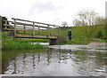
Ford and Footbridge
This ford and footbridge are located at the northern end of the village where an other route with public access crosses the River Cerne just off the A352 Dorchester to Sherborne road.
Image: © Nigel Mykura
Taken: 17 Mar 2012
0.12 miles
10
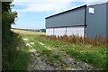
Barn near Charminster
This barn is next to the minor road that runs from the north end of the village west to Wrackleford
Image: © Nigel Mykura
Taken: 24 Jul 2008
0.12 miles