IMAGES TAKEN NEAR TO
Spadger Lane, DORCHESTER, DT2 8UB
Introduction
This page details the photographs taken nearby to Spadger Lane, DT2 8UB by members of the Geograph project.
The Geograph project started in 2005 with the aim of publishing, organising and preserving representative images for every square kilometre of Great Britain, Ireland and the Isle of Man.

There are currently over 7.5m images from over14,400 individuals and you can help contribute to the project by visiting https://www.geograph.org.uk
Image Map (Loading...)


Getting Data...Please wait
Leaflet Map data © OpenStreetMap
Images are licensed for reuse under creativecommons.org/licenses/by-sa/2.0
Notes
- Clicking on the map will re-center to the selected point.
- The higher the marker number, the further away the image location is from the centre of the postcode.
Image Listing (71 Images Found)
Images are licensed for reuse under creativecommons.org/licenses/by-sa/2.0
Image
Details
Distance

2

St Andrew, West Stafford: war memorial (a)
Image: © Basher Eyre
Taken: 3 Sep 2012
0.01 miles
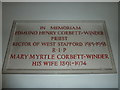
5

St Andrew, West Stafford: memorial (VIII)
Image: © Basher Eyre
Taken: 3 Sep 2012
0.01 miles
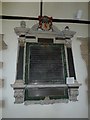
7

St Andrew, West Stafford: memorial (XI)
There is a similar one at Broadmayne http://www.geograph.org.uk/photo/3212133
Image: © Basher Eyre
Taken: 3 Sep 2012
0.01 miles