IMAGES TAKEN NEAR TO
Maiden Newton, DORCHESTER, DT2 0QL
Introduction
This page details the photographs taken nearby to DT2 0QL by members of the Geograph project.
The Geograph project started in 2005 with the aim of publishing, organising and preserving representative images for every square kilometre of Great Britain, Ireland and the Isle of Man.

There are currently over 7.5m images from over14,400 individuals and you can help contribute to the project by visiting https://www.geograph.org.uk
Image Map (Loading...)


Getting Data...Please wait
Leaflet Map data © OpenStreetMap
Images are licensed for reuse under creativecommons.org/licenses/by-sa/2.0
Notes
- Clicking on the map will re-center to the selected point.
- The higher the marker number, the further away the image location is from the centre of the postcode.
Image Listing (5 Images Found)
Images are licensed for reuse under creativecommons.org/licenses/by-sa/2.0
Image
Details
Distance
2
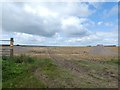
Track across field near Greenford Farm
A bridleway to Wynford Eagle
Image: © David Smith
Taken: 26 Aug 2020
0.09 miles
4
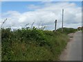
Greenford Lane passing Greenford Farm
The hedge and trees screen the farm from the road; why has a farm on a hilltop been linked to a ford?
Image: © David Smith
Taken: 26 Aug 2020
0.18 miles
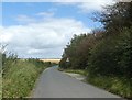
5
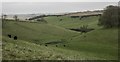
Cruxton Valley
Near Maiden Newton in Dorset.
Image: © Becky Williamson
Taken: 26 Oct 2017
0.23 miles