IMAGES TAKEN NEAR TO
Rampisham, DORCHESTER, DT2 0PW
Introduction
This page details the photographs taken nearby to DT2 0PW by members of the Geograph project.
The Geograph project started in 2005 with the aim of publishing, organising and preserving representative images for every square kilometre of Great Britain, Ireland and the Isle of Man.

There are currently over 7.5m images from over14,400 individuals and you can help contribute to the project by visiting https://www.geograph.org.uk
Image Map
Images are licensed for reuse under creativecommons.org/licenses/by-sa/2.0
Notes
- Clicking on the map will re-center to the selected point.
- The higher the marker number, the further away the image location is from the centre of the postcode.
Image Listing (6 Images Found)
Images are licensed for reuse under creativecommons.org/licenses/by-sa/2.0
Image
Details
Distance
2
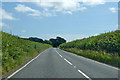
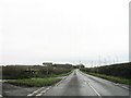
A356 towards Maiden Newton
From the Crewkerne direction.
Image: © Robin Webster
Taken: 20 Jul 2019
0.17 miles
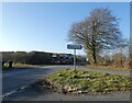
3
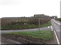
Turn off to Rampisham from the A356
Image: © Becky Williamson
Taken: 4 Jan 2018
0.18 miles
6

Belted Galloways near Rampisham
These distinctive black and white cattle were enjoying several large bales of hay winter feed while the recent snows had started to melt.
Image: © Nigel Mykura
Taken: 27 Dec 2010
0.24 miles