IMAGES TAKEN NEAR TO
Wroot Road, DONCASTER, DN9 3EA
Introduction
This page details the photographs taken nearby to Wroot Road, DN9 3EA by members of the Geograph project.
The Geograph project started in 2005 with the aim of publishing, organising and preserving representative images for every square kilometre of Great Britain, Ireland and the Isle of Man.

There are currently over 7.5m images from over14,400 individuals and you can help contribute to the project by visiting https://www.geograph.org.uk
Image Map
Images are licensed for reuse under creativecommons.org/licenses/by-sa/2.0
Notes
- Clicking on the map will re-center to the selected point.
- The higher the marker number, the further away the image location is from the centre of the postcode.
Image Listing (12 Images Found)
Images are licensed for reuse under creativecommons.org/licenses/by-sa/2.0
Image
Details
Distance
1
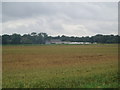
Track to Ellerholme Farm
Seen from just inside the Humberhead Peatlands National Nature Reserve. Ellerholme Farm seems to be a caravan storage site.
Image: © Jonathan Thacker
Taken: 3 Apr 2011
0.04 miles
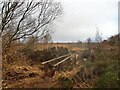
3
Map suggests a path across here
But there isn't, it's been diverted. Humberhead Peatlands National Nature Reserve
Image: © Chris Morgan
Taken: 27 Feb 2023
0.08 miles
4
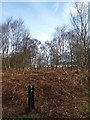
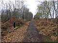
Route marker on a trail in The Humberhead Peatlands National Nature Reserve
In the background are caravans maybe stored at Ellerholme farm?
Image: © Steve Fareham
Taken: 16 Mar 2008
0.12 miles
5
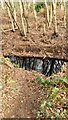
Footbridge leading to Hatfield Moor
Part of the Humberhead Peatlands National Nature Reserve
Image: © Graham Hogg
Taken: 27 Feb 2023
0.14 miles
6
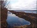
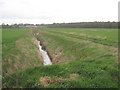
The Humberhead Peatlands National Nature Reserve
Huge area of lakes created by peat extraction.
See http://www.naturalengland.org.uk/ourwork/conservation/designatedareas/nnr/1006766.aspx
Image: © Steve Fareham
Taken: 16 Mar 2008
0.19 miles
7
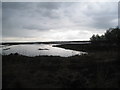
Hatfield Moors before a storm
The water level is kept deliberately high
Image: © Jonathan Thacker
Taken: 3 Apr 2011
0.20 miles
8
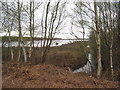
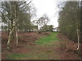
View between the silver birches
Where peat hasn't been extracted this is a landscape of silver birch and acid loving ground cover.
Image: © Jonathan Thacker
Taken: 3 Apr 2011
0.21 miles
10
Track off Moor Lane to Ellerholme Farm
Access to Ellerholme Farm is usually by the lane from Candy Farm Image
Image: © Jonathan Thacker
Taken: 3 Apr 2011
0.23 miles