IMAGES TAKEN NEAR TO
Chapel Close, DONCASTER, DN9 2PD
Introduction
This page details the photographs taken nearby to Chapel Close, DN9 2PD by members of the Geograph project.
The Geograph project started in 2005 with the aim of publishing, organising and preserving representative images for every square kilometre of Great Britain, Ireland and the Isle of Man.

There are currently over 7.5m images from over14,400 individuals and you can help contribute to the project by visiting https://www.geograph.org.uk
Image Map
Images are licensed for reuse under creativecommons.org/licenses/by-sa/2.0
Notes
- Clicking on the map will re-center to the selected point.
- The higher the marker number, the further away the image location is from the centre of the postcode.
Image Listing (17 Images Found)
Images are licensed for reuse under creativecommons.org/licenses/by-sa/2.0
Image
Details
Distance
1
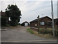
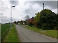
Cottages on Upperthorpe Hill
Amongst the suburban developments of Upperthorpe some old buildings still survive.
Image: © Jonathan Thacker
Taken: 29 Jul 2010
0.06 miles
3
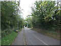
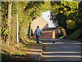
Footpath on Upperthorpe Hill
Well-used path on the fringes of Westwoodside.
Image: © Jonathan Clitheroe
Taken: 12 Mar 2016
0.11 miles
4
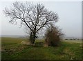
Tower Hill
Bagged the water tower then 13 and 14 Mill Lane.
Name: Tower Hill
Hill number: 16860
Height: 41m / 135ft
Parent (Ma/M): 2807 Kinder Scout
Section: 37: The River Tees to The Wash
County/UA: North Lincolnshire (UA)
Class: Tump (0-99m)
Grid ref: SK758999 (est)
Drop: 40m
Col: 1m
Image: © Rude Health
Taken: 2 May 2015
0.16 miles
5
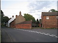
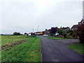
Upperthorpe Hill, Westwoodside
Road running along the northern edge of the village
Image: © Paul Harrop
Taken: 25 Oct 2016
0.17 miles
6
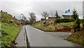
Upperthorpe Hill, Westwoodside
The Yorkshire flag proudly displayed in Lincolnshire
Image: © Chris Morgan
Taken: 21 Nov 2017
0.17 miles
8
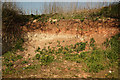
Sedimentary layers
Sedimentary layers exposed on Upperthorpe Hill http://www.geograph.org.uk/photo/2883261
Image: © Richard Croft
Taken: 28 Mar 2012
0.18 miles