IMAGES TAKEN NEAR TO
Massey Close, DONCASTER, DN9 1TN
Introduction
This page details the photographs taken nearby to Massey Close, DN9 1TN by members of the Geograph project.
The Geograph project started in 2005 with the aim of publishing, organising and preserving representative images for every square kilometre of Great Britain, Ireland and the Isle of Man.

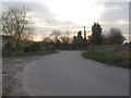
There are currently over 7.5m images from over14,400 individuals and you can help contribute to the project by visiting https://www.geograph.org.uk
Image Map
Images are licensed for reuse under creativecommons.org/licenses/by-sa/2.0
Notes
- Clicking on the map will re-center to the selected point.
- The higher the marker number, the further away the image location is from the centre of the postcode.
Image Listing (13 Images Found)
Images are licensed for reuse under creativecommons.org/licenses/by-sa/2.0
Image
Details
Distance
2
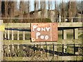
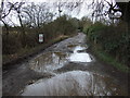
Free offer
Sign near a field in carrside.
Image: © Ian Paterson
Taken: 18 Dec 2011
0.11 miles
3
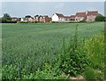
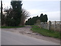
Cornfield and modern houses in Epworth
To the south west of the village
Image: © Neil Theasby
Taken: 17 Jun 2020
0.12 miles
5
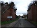
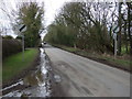
Entering Epworth
Heading east on Carrside past the remains of a disused railway bridge.
Image: © JThomas
Taken: 28 Feb 2015
0.14 miles
10
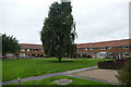
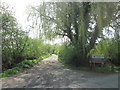
Housing on Fieldside
Terraced houses built on three sides of a rectangular open space
Image: © Graham Hogg
Taken: 8 Sep 2015
0.18 miles