
IMAGES TAKEN NEAR TO
Trentside, DONCASTER, DN9 1RS
Introduction
This page details the photographs taken nearby to Trentside, DN9 1RS by members of the Geograph project.
The Geograph project started in 2005 with the aim of publishing, organising and preserving representative images for every square kilometre of Great Britain, Ireland and the Isle of Man.

There are currently over 7.5m images from over14,400 individuals and you can help contribute to the project by visiting https://www.geograph.org.uk
Image Map
Images are licensed for reuse under creativecommons.org/licenses/by-sa/2.0
Notes
- Clicking on the map will re-center to the selected point.
- The higher the marker number, the further away the image location is from the centre of the postcode.
Image Listing (63 Images Found)
Images are licensed for reuse under creativecommons.org/licenses/by-sa/2.0
Image
Details
Distance
1
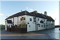
The Crooked Billet
A riverside pub in Owston Ferry
Image: © Graham Hogg
Taken: 8 Dec 2015
0.00 miles
2
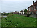
Waiting for the Trent Aegir - Owston Ferry
Owston Ferry flood defences are a popular place to view the Trent Aegir. Unfortunately the very small Aegir (Tidal bore) had passed without being noticed. On this day it had been predicted to be a large one.
Image: © Nigel Homer
Taken: 29 Sep 2007
0.02 miles
3
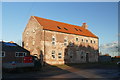
Warehouse conversion
Last photographed in 2010 as the restoration was in progress Image
Image: © Graham Hogg
Taken: 8 Dec 2015
0.02 miles
4
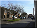
Silver Street flats, Owston Ferry
Looking south from the Market Place. Modern residential infill on the left.
Image: © Alan Murray-Rust
Taken: 13 Mar 2011
0.02 miles
5
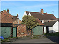
Buildings at Owston Ferry
Vernacular architecture at the back of the bottom end of High Street.
Image: © Alan Murray-Rust
Taken: 13 Mar 2011
0.03 miles
6
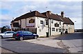
Crooked Billet (1), Silver Street, Owston Ferry, Lincs
Popular public house with the River Trent running behind. Food available at certain times. Also sports TV.
Image
Image
Image: © P L Chadwick
Taken: 31 Mar 2013
0.03 miles
7
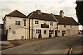
The Crooked Billet
Trent-side pub at Owston Ferry
Image: © Richard Croft
Taken: 16 Feb 2012
0.03 miles
8
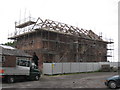
Eighteenth century warehouse under conversion
Image: © Jonathan Thacker
Taken: 14 Jun 2010
0.03 miles
9
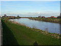
River Trent at Owston Ferry
Looking north from near The Crooked Billet. The ferry from which the villages on both sides get their name would have crossed somewhere here. Today there is no obvious sign of the crossing point.
Image: © Alan Murray-Rust
Taken: 13 Mar 2011
0.03 miles
10
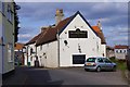
Crooked Billet (3), Silver Street, Owston Ferry, Lincs
Image: © P L Chadwick
Taken: 31 Mar 2013
0.03 miles