IMAGES TAKEN NEAR TO
Woodhouse, DONCASTER, DN9 1QJ
Introduction
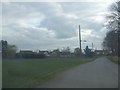
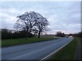
This page details the photographs taken nearby to Woodhouse, DN9 1QJ by members of the Geograph project.
The Geograph project started in 2005 with the aim of publishing, organising and preserving representative images for every square kilometre of Great Britain, Ireland and the Isle of Man.

There are currently over 7.5m images from over14,400 individuals and you can help contribute to the project by visiting https://www.geograph.org.uk
Image Map
Images are licensed for reuse under creativecommons.org/licenses/by-sa/2.0
Notes
- Clicking on the map will re-center to the selected point.
- The higher the marker number, the further away the image location is from the centre of the postcode.
Image Listing (11 Images Found)
Images are licensed for reuse under creativecommons.org/licenses/by-sa/2.0
Image
Details
Distance
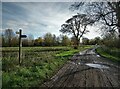
4
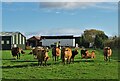
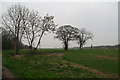
Cattle at Woodhouse Grange Farm, Belton
Image: © Neil Theasby
Taken: 12 Nov 2020
0.14 miles
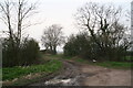
8
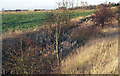
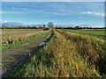
Roadside Ditch
Sandwiched between the A161 and the adjacent field this ditch near Woodhouse provides some natural habitat for wildlife. The road in the background is the M180.
Image: © David Wright
Taken: 9 Dec 2006
0.22 miles