IMAGES TAKEN NEAR TO
Epworth Road, DONCASTER, DN9 1NY
Introduction
This page details the photographs taken nearby to Epworth Road, DN9 1NY by members of the Geograph project.
The Geograph project started in 2005 with the aim of publishing, organising and preserving representative images for every square kilometre of Great Britain, Ireland and the Isle of Man.

There are currently over 7.5m images from over14,400 individuals and you can help contribute to the project by visiting https://www.geograph.org.uk
Image Map
Images are licensed for reuse under creativecommons.org/licenses/by-sa/2.0
Notes
- Clicking on the map will re-center to the selected point.
- The higher the marker number, the further away the image location is from the centre of the postcode.
Image Listing (12 Images Found)
Images are licensed for reuse under creativecommons.org/licenses/by-sa/2.0
Image
Details
Distance
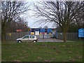
1
Save some of your picnic to feed the ducks
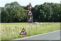
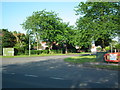
Road signs on the A161 approaching Epworth
Image: © Graham Hogg
Taken: 8 Sep 2015
0.09 miles
2
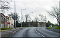
A161 near Church Town
Heading south towards Epworth.
Image: © J.Hannan-Briggs
Taken: 26 Dec 2015
0.13 miles
6
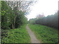
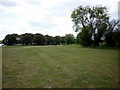
The Peatlands Way heading south from Belton
Image: © John Slater
Taken: 28 Apr 2015
0.22 miles
7
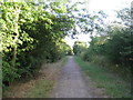
Bridleway leading to A161
This bridleway follows the course of the former Axholme Joint Railway which opened in 1905, closed to passengers in 1938 and closed to all traffic in 1965.
Image: © Jonathan Thacker
Taken: 27 Jul 2010
0.22 miles
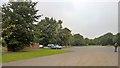
10
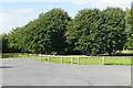
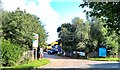
Car park and picnic area off the A161 at Epworth
Image: © Graham Hogg
Taken: 8 Sep 2015
0.23 miles