IMAGES TAKEN NEAR TO
Beltoft, DONCASTER, DN9 1LY
Introduction
This page details the photographs taken nearby to DN9 1LY by members of the Geograph project.
The Geograph project started in 2005 with the aim of publishing, organising and preserving representative images for every square kilometre of Great Britain, Ireland and the Isle of Man.

There are currently over 7.5m images from over14,400 individuals and you can help contribute to the project by visiting https://www.geograph.org.uk
Image Map
Images are licensed for reuse under creativecommons.org/licenses/by-sa/2.0
Notes
- Clicking on the map will re-center to the selected point.
- The higher the marker number, the further away the image location is from the centre of the postcode.
Image Listing (11 Images Found)
Images are licensed for reuse under creativecommons.org/licenses/by-sa/2.0
Image
Details
Distance
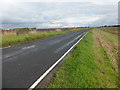
4
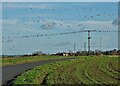
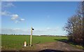
Birds on The Wires - On Belton Road heading to Beltoft
Image: © Neil Theasby
Taken: 12 Nov 2020
0.14 miles
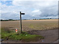
5
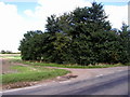
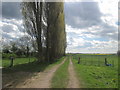
Footpath to Mill Hill
The footpath sign is now totally obscured by the growing copse!
Image: © Andy Beecroft
Taken: 25 Aug 2006
0.17 miles
7
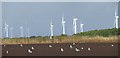
Turbines and gulls
Gulls enjoying a meal in a recently ploughed field with the distant turbines of the Tween Bridge windfarm catching some afternoon sun
Image: © Graham Hogg
Taken: 15 Sep 2015
0.19 miles
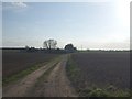
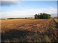
10
Bridleway sign beside a field of stubble
Image: © Graham Hogg
Taken: 15 Sep 2015
0.21 miles