IMAGES TAKEN NEAR TO
Epworth, DONCASTER, DN9 1AA
Introduction
This page details the photographs taken nearby to DN9 1AA by members of the Geograph project.
The Geograph project started in 2005 with the aim of publishing, organising and preserving representative images for every square kilometre of Great Britain, Ireland and the Isle of Man.

There are currently over 7.5m images from over14,400 individuals and you can help contribute to the project by visiting https://www.geograph.org.uk
Image Map
Images are licensed for reuse under creativecommons.org/licenses/by-sa/2.0
Notes
- Clicking on the map will re-center to the selected point.
- The higher the marker number, the further away the image location is from the centre of the postcode.
Image Listing (16 Images Found)
Images are licensed for reuse under creativecommons.org/licenses/by-sa/2.0
Image
Details
Distance
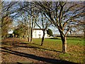
4
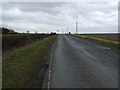
Melwood Hill
Heading up the hill towards the south.
Image: © JThomas
Taken: 28 Feb 2015
0.08 miles
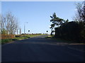
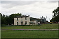
7
Newland Lane Corner
Just on the outskirts of the village of Epworth.
Image: © Andy Beecroft
Taken: 25 Aug 2006
0.11 miles
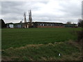
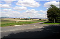
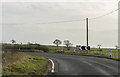
8
Corner of Newlands Lane with Melwood Hill
Image: © Chris Morgan
Taken: 8 Sep 2015
0.12 miles
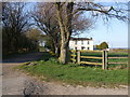
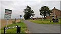
9
Bend on Melwood Hill
Heading out of Epworth.
Image: © J.Hannan-Briggs
Taken: 26 Dec 2015
0.12 miles
